Maps & Cartography
Fantasy Overworld Realm Map
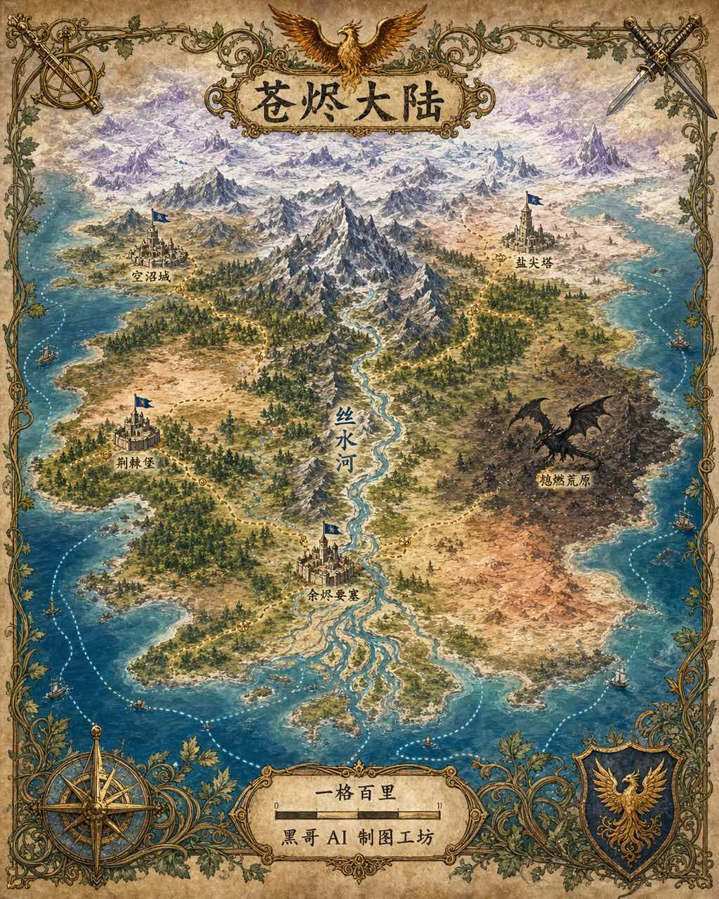
A painterly overworld map of a fantasy continent named "Vaelorin", top-down with slight tilt to suggest depth. Mountains rise as ridge-shad…
Digital PaintingMedieval
Hand-drawn city maps, fantasy world maps, transit diagrams, and illustrated tourist guides.
40 cases
40 cases
Maps & Cartography
A painterly overworld map of a fantasy continent named "Vaelorin", top-down with slight tilt to suggest depth. Mountains rise as ridge-shad…
Maps & Cartography
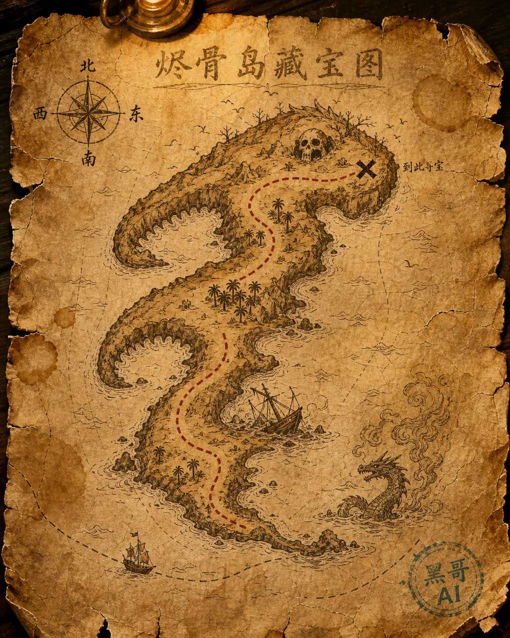
A weathered treasure map painted on cracked parchment, top-down view filling the frame. The island is shaped like a sleeping sea serpent wi…
Maps & Cartography
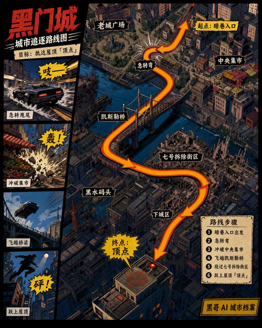
A dynamic comic-book-style city map of the fictional metropolis "Gallowgate City", laid out as a top-down chase-route sequence. The city bl…
Maps & Cartography
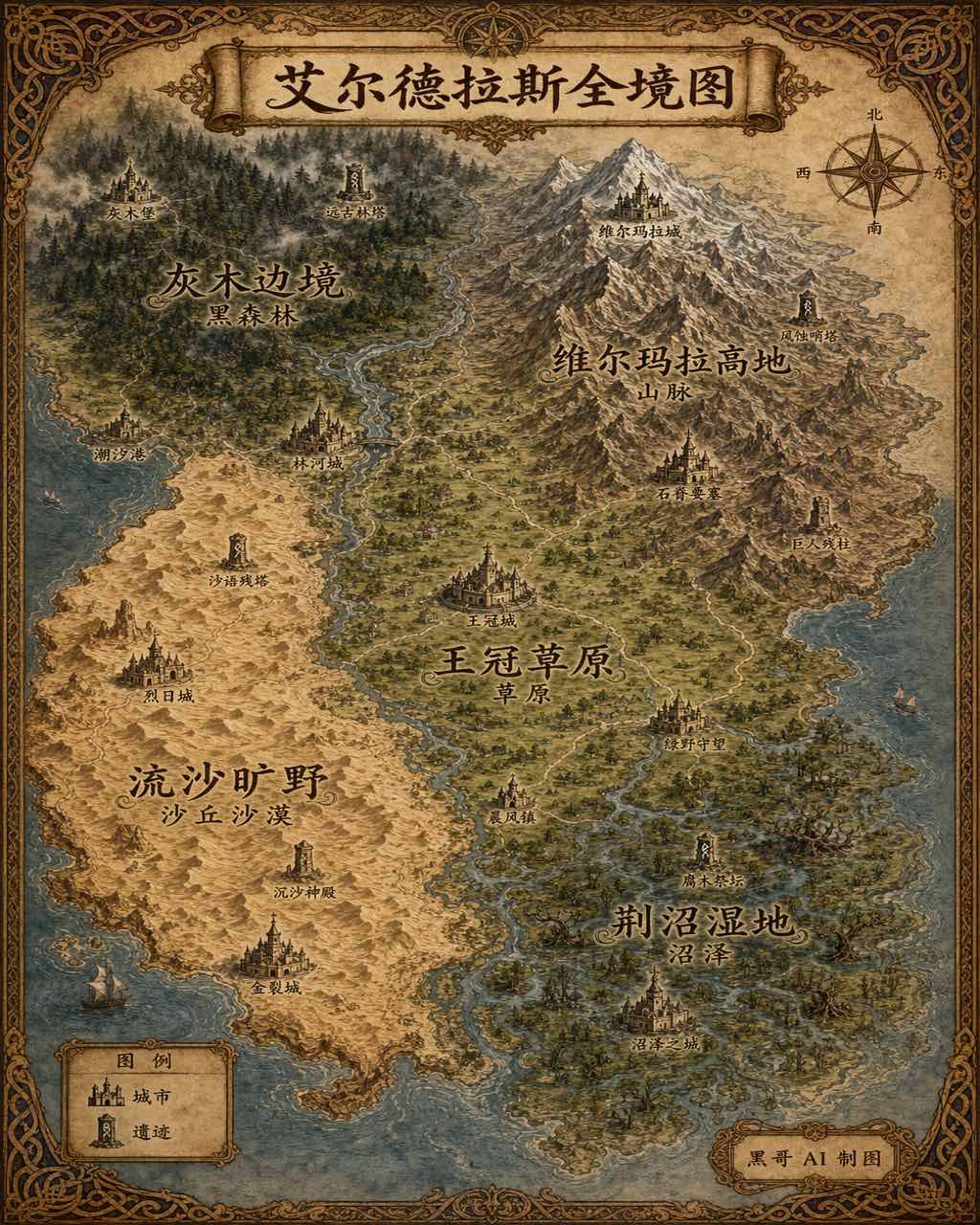
A sweeping overview map of the fantasy continent "Aeldrath", painted in a classic fantasy atlas style with warm parchment tones. The contin…
Maps & Cartography
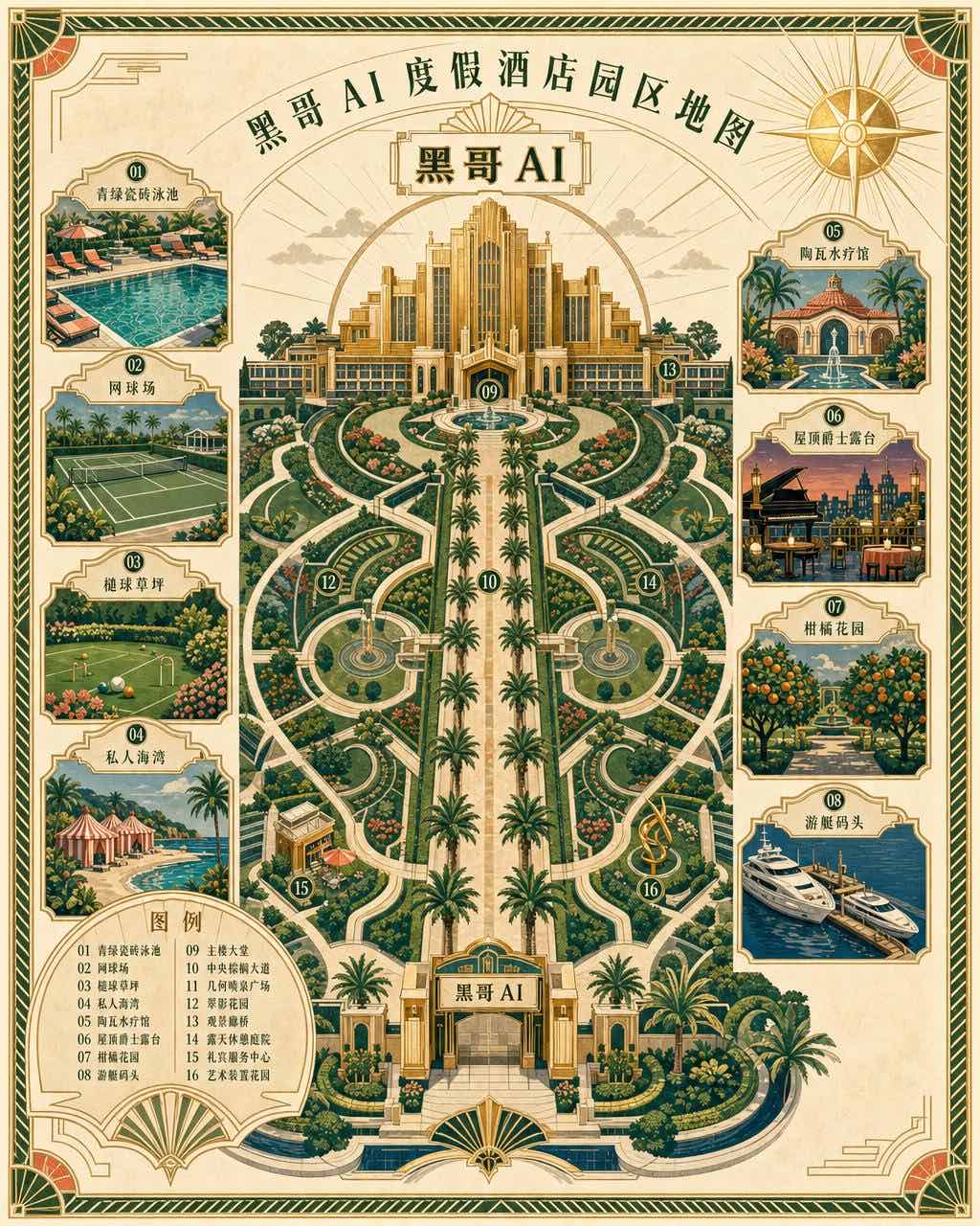
An elegant art-deco grounds map for a fictional seaside resort called "Hotel Bellaluna", three-quarter top-down view rendered as a vintage…

Maps & Cartography
A warm illustrated world map centered on the equatorial coffee belt, designed for a specialty roastery's wall poster. Continents are render…
Maps & Cartography
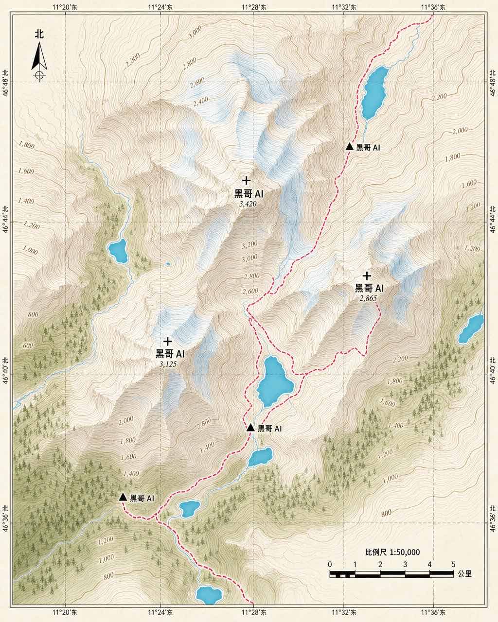
A clean editorial topographic map of a fictional alpine region called "Aldur Massif", top-down view. The composition is built from finely-s…
Maps & Cartography
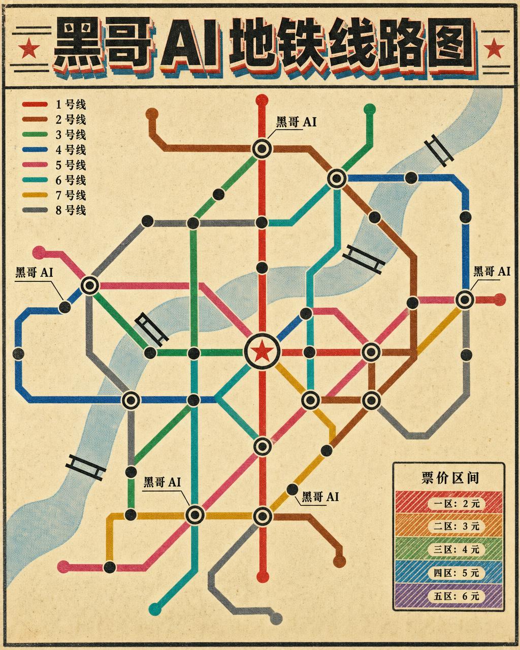
A flat schematic transit map in the spirit of mid-century east-European metro diagrams, rendered for a fictional city called "Krestov". Eig…

Maps & Cartography
A layered paper-cut style map of a quiet residential neighborhood, photographed straight down. Each element is constructed from cut paper w…
Maps & Cartography
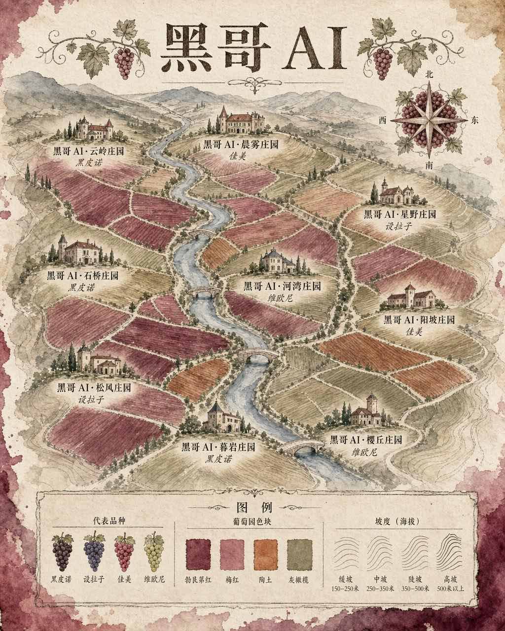
A loose, lyrical watercolor map of a fictional wine valley called "Vallee de Sirelune", three-quarter top-down view on cotton paper. Vineya…

Maps & Cartography
A clean equirectangular world map flattened across a soft midnight-navy background, designed for an airline campaign. Continents are render…
Maps & Cartography
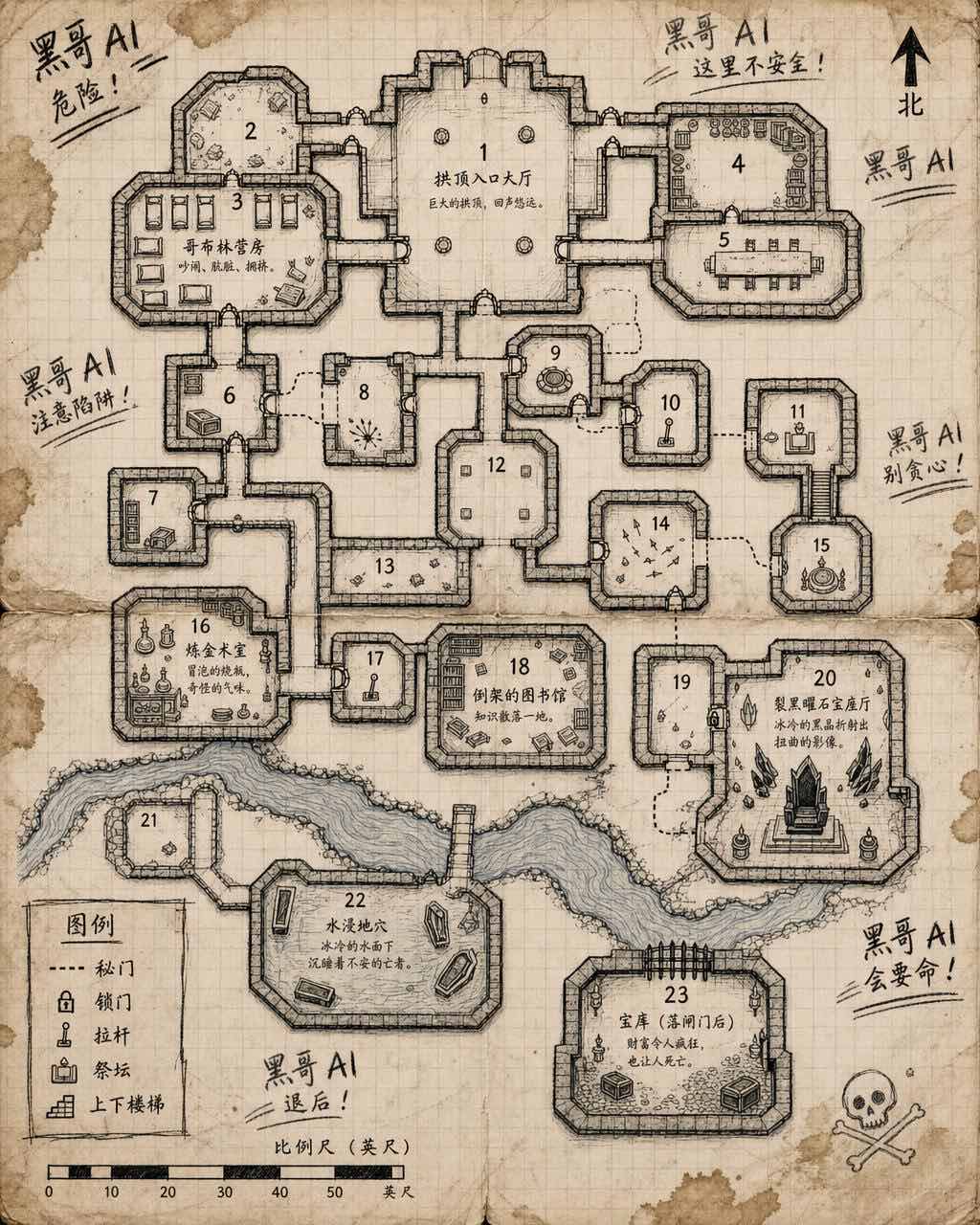
A top-down tabletop RPG dungeon floor plan rendered in crisp black ink on warm cream graph paper. The layout features twenty-three numbered…
Maps & Cartography
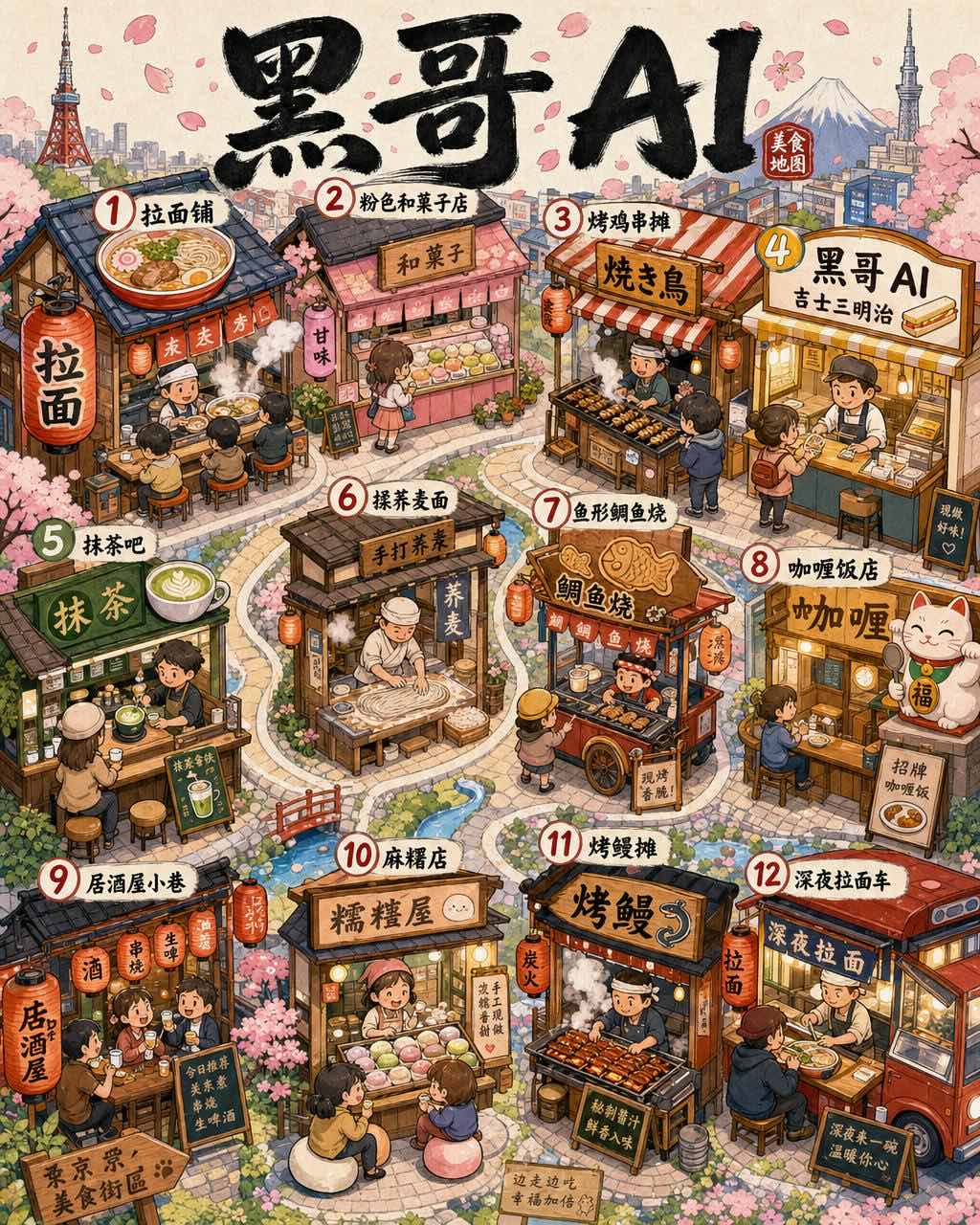
A cheerful illustrated food tour map of a fictional Tokyo-inspired ward called "Hanamaru", three-quarter top-down view. Streets are gently…
Maps & Cartography
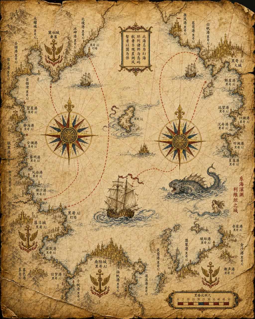
A renaissance-era portolan-style nautical chart of a fictional inland sea, painted on aged vellum. Coastlines are drawn with meticulous qui…

Maps & Cartography
A retro WPA-poster-inspired illustrated map of a fictional national park called "Pine Hollow National Park", three-quarter top-down view. R…

Maps & Cartography
An isometric cutaway view of a fictional six-line subway network beneath a stylized city, rendered as a clean vector illustration. The grou…
Maps & Cartography
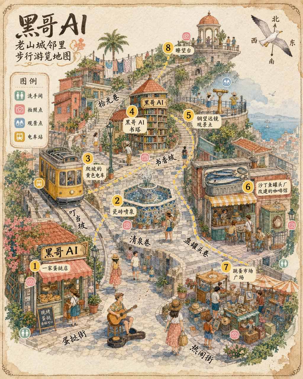
A friendly hand-drawn walking tour map of an old hillside neighborhood, three-quarter perspective with buildings drawn in playful axonometr…
Maps & Cartography
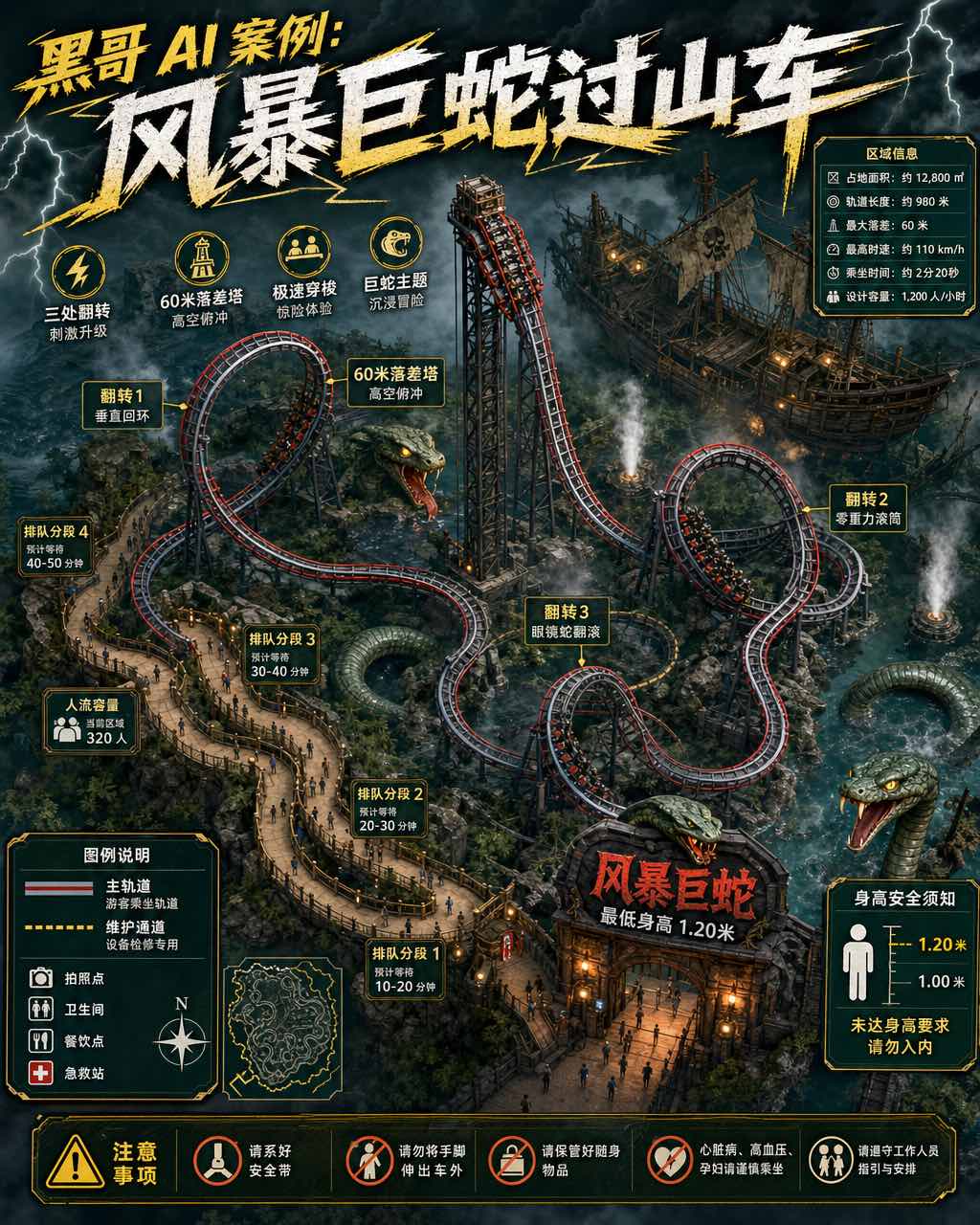
A detailed illustrated map focusing on a single themed ride area within a fictional theme park: the "Storm Serpent Coaster" zone in "Skyfal…
Maps & Cartography
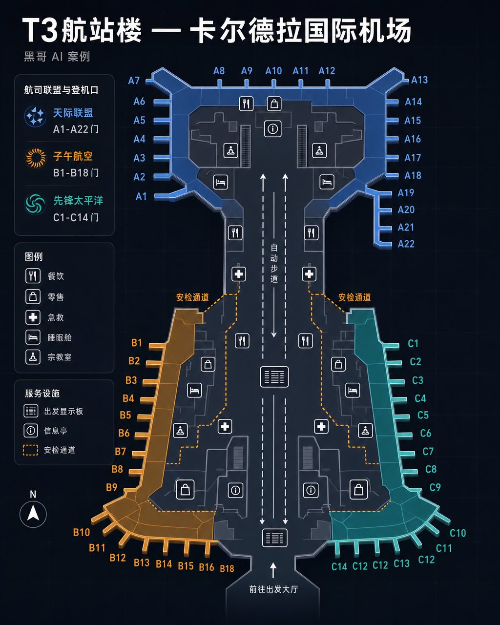
A sleek dark-mode airport terminal wayfinding map for the fictional "Caldera International Airport", Terminal 3. The background is deep cha…
Maps & Cartography
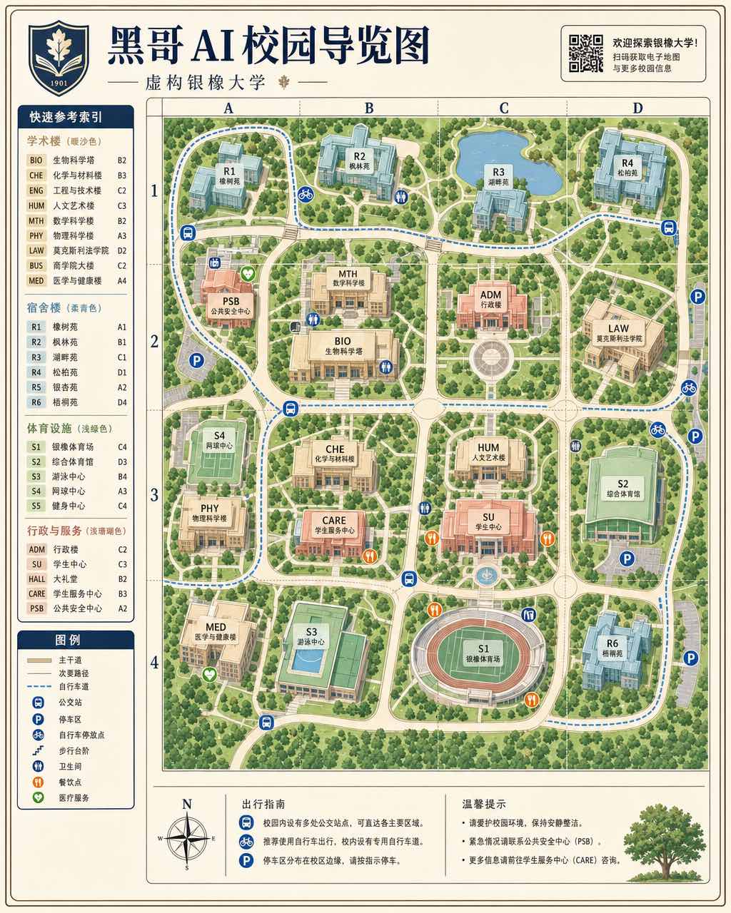
A crisp modern campus map for the fictional "Silveroak University", designed in the clean wayfinding style of a contemporary university's p…
Maps & Cartography
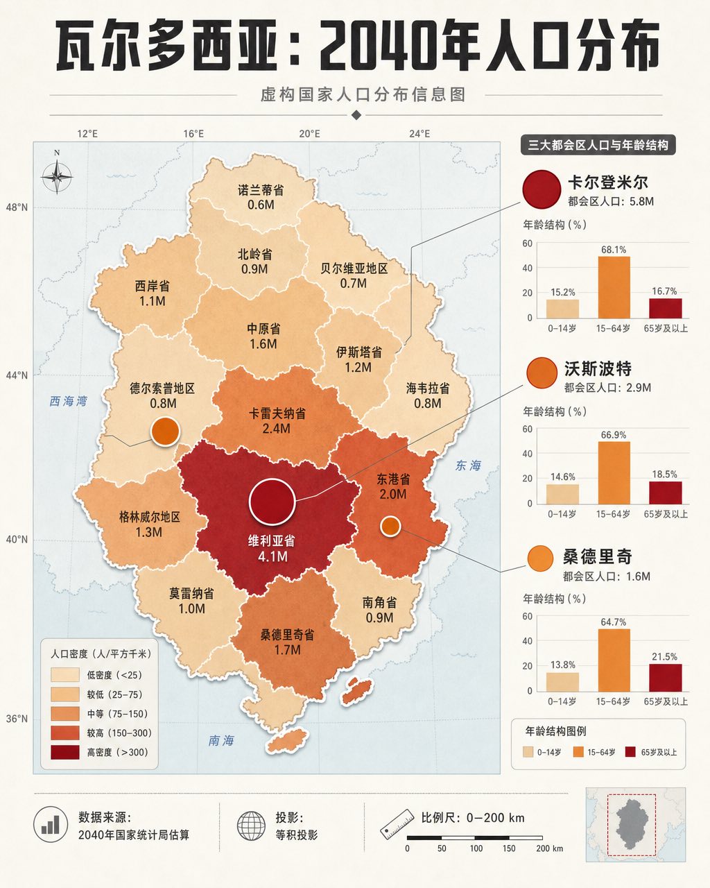
An infographic-style population distribution map of the fictional country "Valdosia", rendered in a clean data-journalism aesthetic. The co…
Maps & Cartography
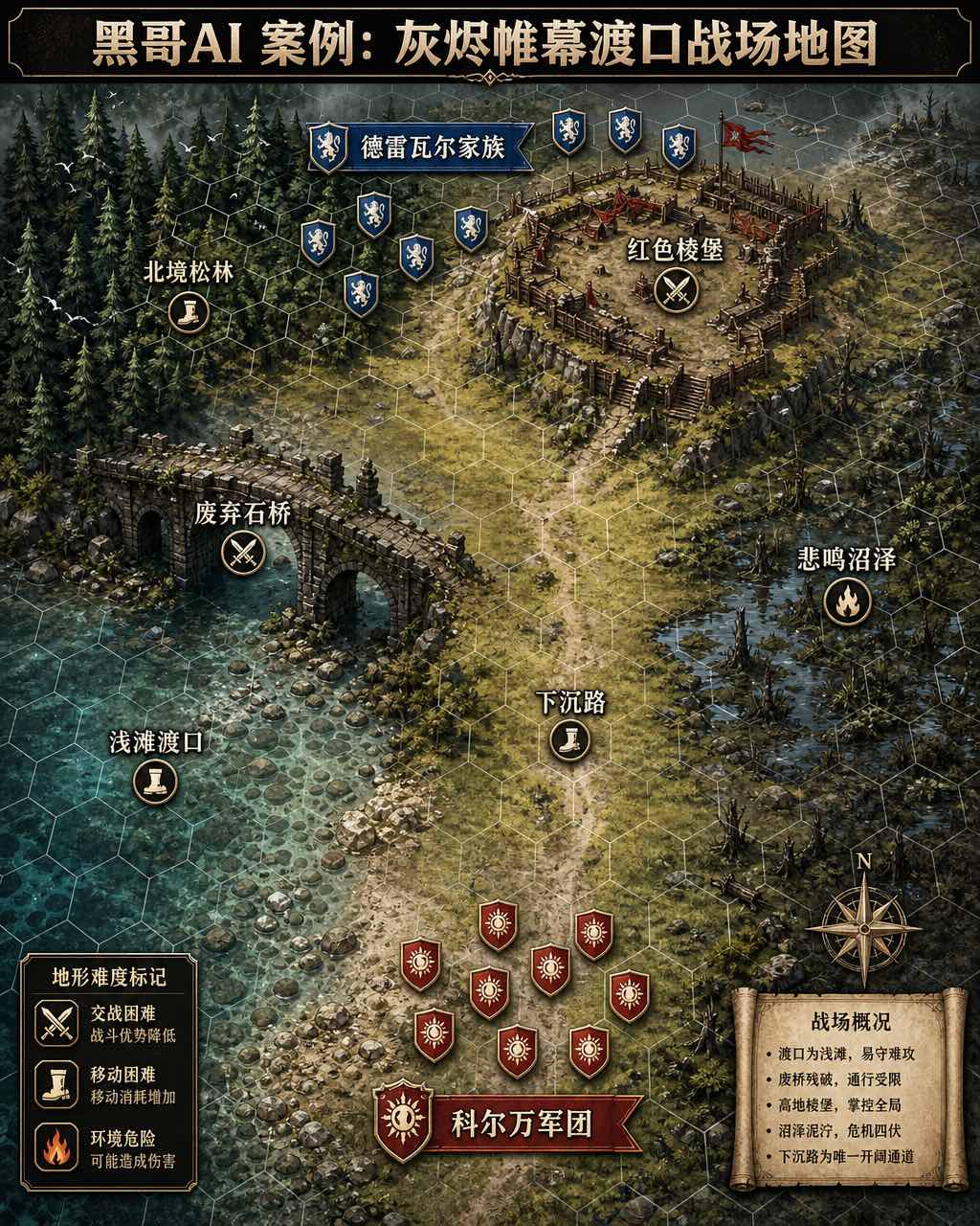
A detailed tabletop-RPG-style battle map of the fictional battlefield "Ashveil Crossing", rendered from a near-overhead perspective with a…
Maps & Cartography
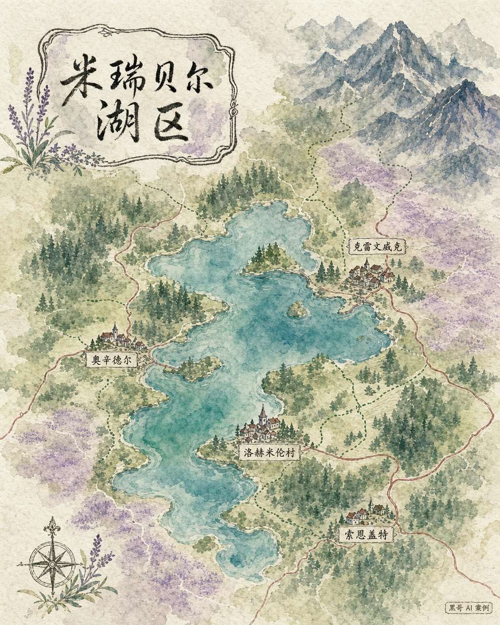
A soft, luminous watercolor regional map of the fictional lake district "Mirebell Lakes", painted in the manner of a high-quality illustrat…
Maps & Cartography
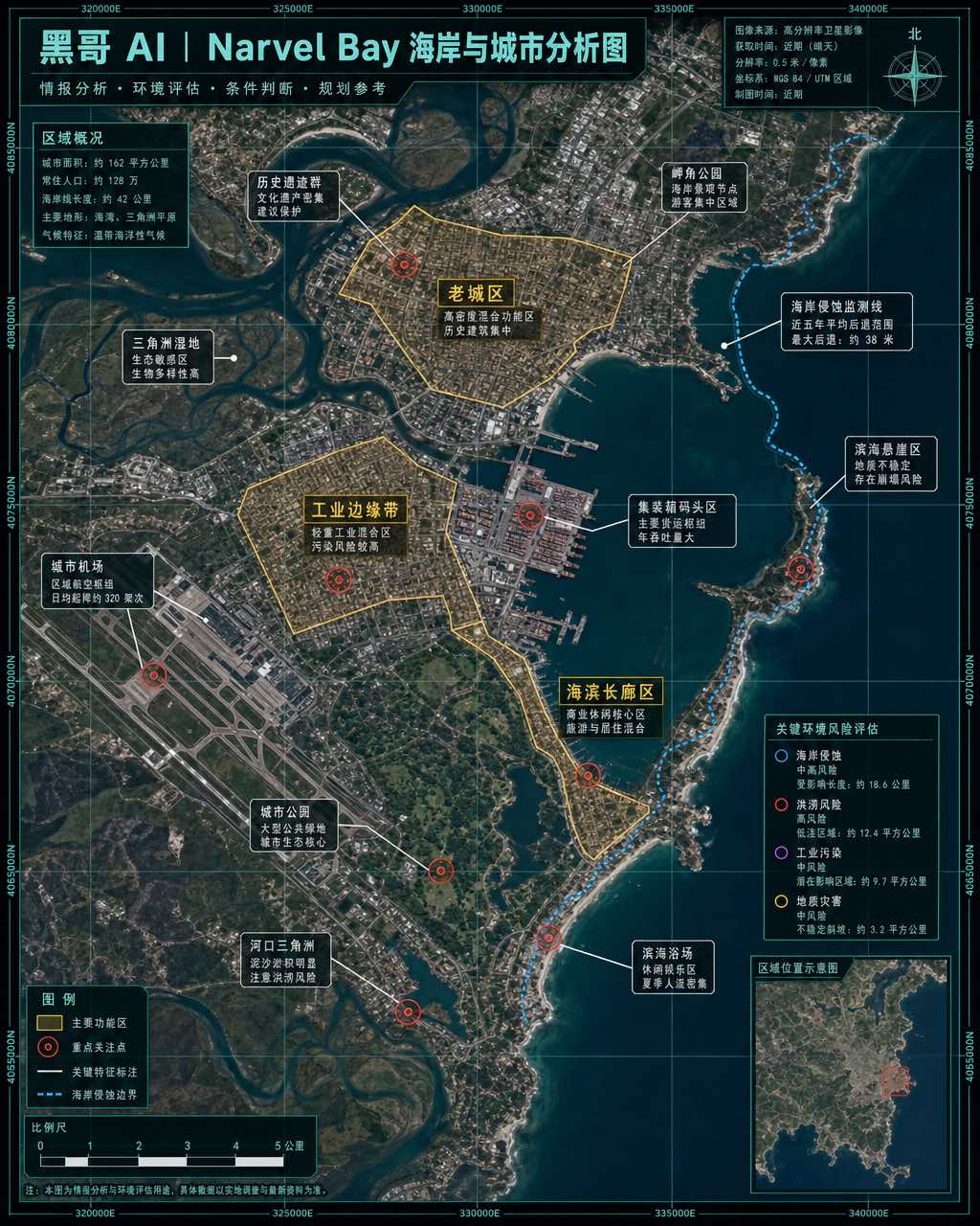
A composite satellite-imagery-style map of the fictional coastal city "Narvel Bay", presented as an annotated intelligence or environmental…