Illustrated National Park Trail Map
This is a Maps & Cartography AI image prompt case, leaning toward Flat, Retro. Copy the full prompt below and paste it into a free GPT image generator to create your own image with GPT Image-2 — swap the subject, brand, or aspect ratio as needed.
English full prompt
A retro WPA-poster-inspired illustrated map of a fictional national park called "Pine Hollow National Park", three-quarter top-down view. Rolling hills are layered in flat shapes of pine, sage, and dusty terracotta. A meandering river loops past a teal kettle lake labeled "Mirror Tarn". Five color-coded trails fan out from a central ranger station: green for easy, blue for moderate, red for strenuous, purple for backcountry, and yellow for ADA-accessible. Trail markers show distances in miles. Icons indicate a black-bear meadow, a fire-watch tower, a bat-roost cave, a waterfall with a small wooden footbridge, and a star-gazing meadow. A pair of pine trees frames the lower foreground. The title "Pine Hollow National Park" appears in chunky slab-serif letters across the top, with the subtitle "Established 1932". A legend in the lower-left lists trail difficulty, water sources, restrooms, and camping. Muted retro palette: cream, forest, ochre, brick, and slate. Subtle paper grain throughout, slight halftone dot shading on hills, and a soft drop shadow under the title.
中文完整提示词
一张受 WPA 海报启发的复古插画国家公园地图,公园名为 「Pine Hollow National Park」,三分之四俯视。起伏山丘由松绿、鼠尾草绿、灰陶土色的扁平色块层叠而成。蜿蜒河流绕过青蓝色冰川湖 「Mirror Tarn」。五条彩色步道从中央护林员站发散:绿色简易、蓝色中等、红色高难、紫色野外、黄色无障碍。步道标牌标英里里程。图标显示黑熊草甸、瞭望火塔、蝙蝠栖洞穴、带木桥的瀑布和观星草甸。前景下方以两棵松树框景。顶部粗板衬线字写着 「Pine Hollow National Park」,副标 「Established 1932」。左下图例列出步道难度、水源、洗手间和露营。复古配色:奶白、森绿、赭石、砖红、石板。整体淡纸纹,山丘有半色调点纹理,标题下有柔阴影。
Related cases
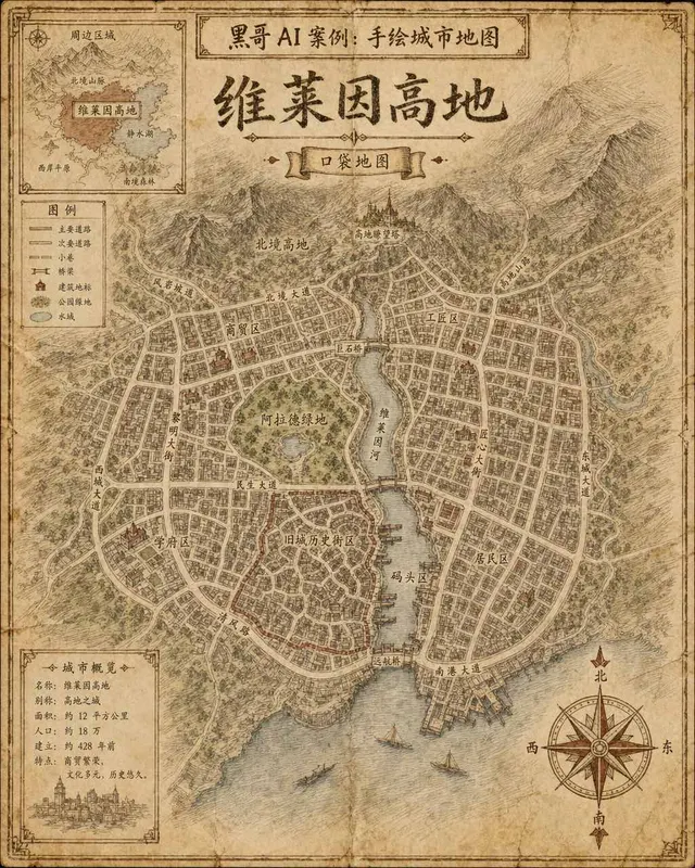
Hand-Drawn Fictional City Map
A hand-drawn city street map of the fictional municipality "Verlaine Heights", rendered as if sketched in brown ink on aged cream cartridge paper. Top-down orthographic view of a…

Neon Dark-Mode Subway Diagram
A clean transit diagram for the fictional underground network of "Orveka City", displayed on a near-black (#0d0d14) background. Twelve colour-coded lines arc and intersect across…
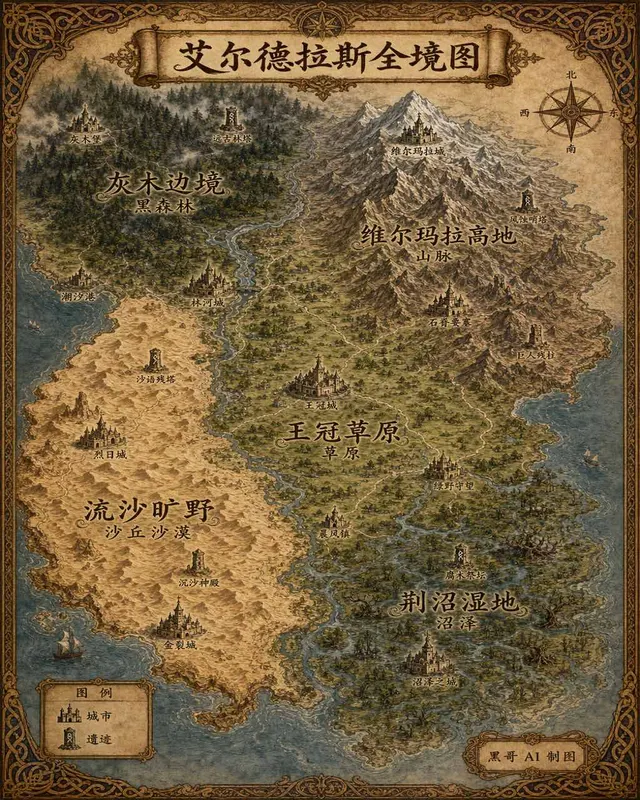
Illustrated Fantasy World Overview Map
A sweeping overview map of the fantasy continent "Aeldrath", painted in a classic fantasy atlas style with warm parchment tones. The continent spans most of the image, surrounded…
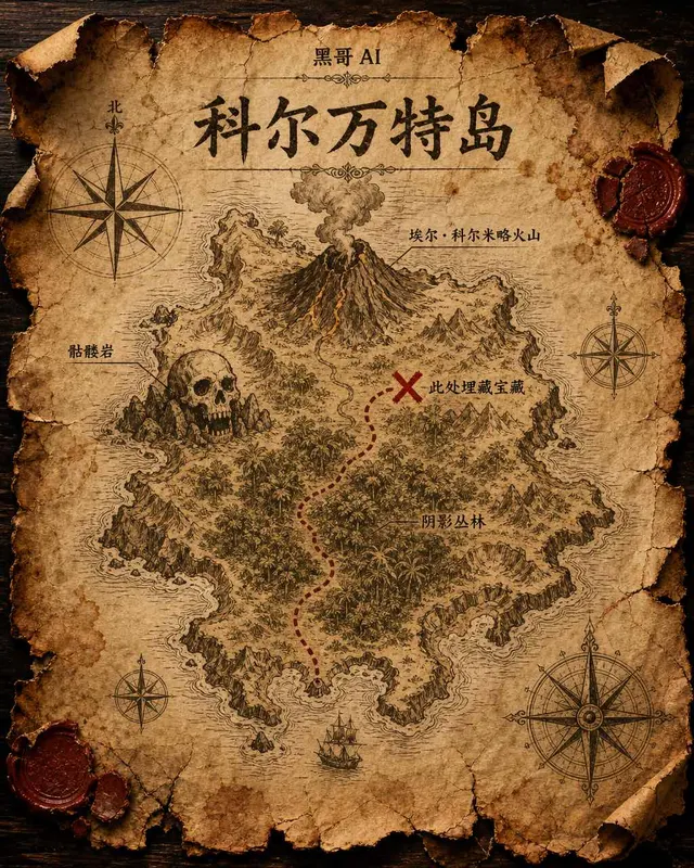
Treasure Island Parchment Map
A worn parchment treasure map of the fictional island "Isla de Corvante", rendered with aged sepia ink on crinkled vellum. The island's irregular coastline is drawn with careful h…