Hand-Drawn Fictional City Map
This is a Maps & Cartography AI image prompt case, leaning toward Sketch, Vintage, Line Art. Copy the full prompt below and paste it into a free GPT image generator to create your own image with GPT Image-2 — swap the subject, brand, or aspect ratio as needed.
English full prompt
A hand-drawn city street map of the fictional municipality "Verlaine Heights", rendered as if sketched in brown ink on aged cream cartridge paper. Top-down orthographic view of a dense grid of named streets, a river bisecting the city, a central park labeled "Allard Green", and a historic quarter with winding lanes. Street names are hand-lettered in a slightly uneven serif script. A decorative compass rose sits in the lower-right corner; a small inset box in the upper-left shows the surrounding region. Pencil hatching marks elevated terrain to the north. The overall palette is sepia, ivory, and soft rust, with a subtle paper-grain texture and faint fold creases suggesting a pocket map. Ink weight varies from fine capillary lines for alleys to bold strokes for arterial roads. No digital-looking gradients; everything reads as a lovingly made analogue artefact.
中文完整提示词
一张虚构城市「Verlaine Heights」的手绘街道地图,以棕色墨水绘于泛黄奶油色绘图纸上,俯视正交视角。密集的街道网格、一条将城市一分为二的河流、中央公园标注为「Allard Green」,以及蜿蜒的历史街区。街道名以略显不规则的衬线手写体标注,右下角绘有装饰性罗盘玫瑰,左上角有显示周边区域的小插图。铅笔排线标示北部高地,整体色调为深褐色、象牙白与锈红,带有细腻纸纹与折痕,呈现口袋地图质感。
Related cases

Neon Dark-Mode Subway Diagram
A clean transit diagram for the fictional underground network of "Orveka City", displayed on a near-black (#0d0d14) background. Twelve colour-coded lines arc and intersect across…
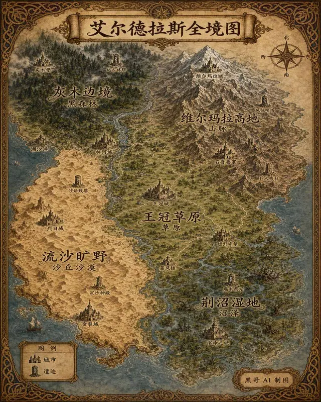
Illustrated Fantasy World Overview Map
A sweeping overview map of the fantasy continent "Aeldrath", painted in a classic fantasy atlas style with warm parchment tones. The continent spans most of the image, surrounded…
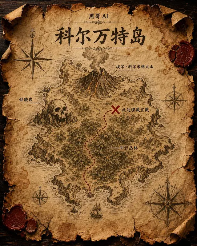
Treasure Island Parchment Map
A worn parchment treasure map of the fictional island "Isla de Corvante", rendered with aged sepia ink on crinkled vellum. The island's irregular coastline is drawn with careful h…
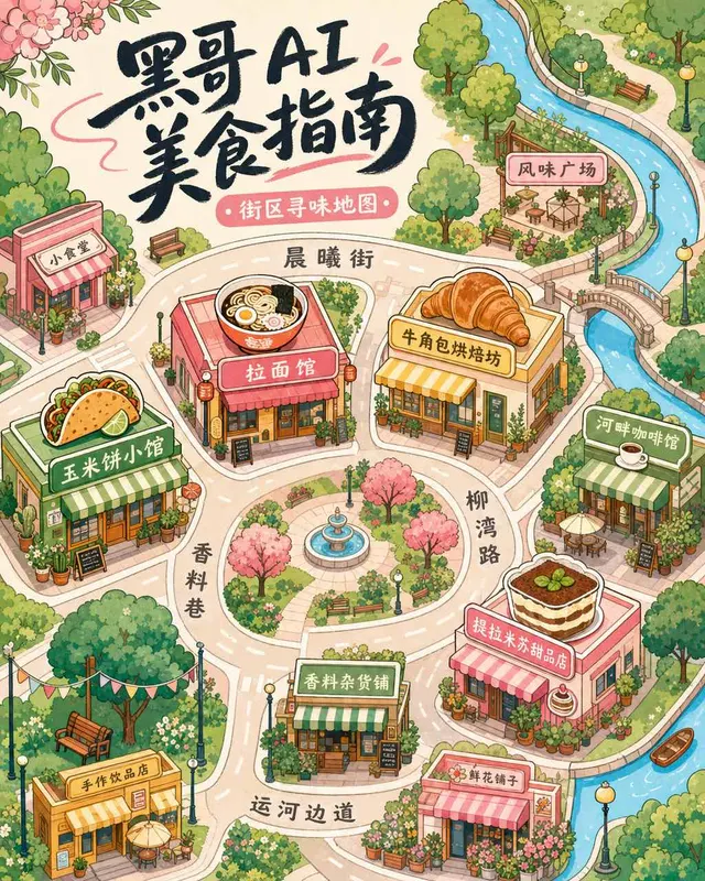
Illustrated Neighborhood Food Guide Map
A charming illustrated food guide map of the fictional "Brindlewick Quarter", rendered in a bright flat-illustration style with pastel fills and crisp black outlines. The bird's-e…