Neon Dark-Mode Subway Diagram
This is a Maps & Cartography AI image prompt case, leaning toward Minimalist, Dark Mode, Neon. Copy the full prompt below and paste it into a free GPT image generator to create your own image with GPT Image-2 — swap the subject, brand, or aspect ratio as needed.
English full prompt
A clean transit diagram for the fictional underground network of "Orveka City", displayed on a near-black (#0d0d14) background. Twelve colour-coded lines arc and intersect across the canvas using strict 45-degree angles in the classic schematic style. Each line is a bold 4px stroke in a distinct vivid colour: electric lime, neon coral, sky cyan, amber, violet, and six others. Station dots are white circles; interchange stations are larger multi-ring markers. Station names are set in a tight grotesque sans-serif typeface in white, with a subtle glow effect where names overlap busy junctions. A legend sits bottom-left listing line names: "Cerulean Line", "Amber Line", "Vantage Line", etc. The overall aesthetic is crisp and futuristic, inspired by classic European metro schematics but with a contemporary dark-mode energy. No geographic accuracy implied — pure schematic topology.
中文完整提示词
虚构城市「Orveka City」地下网络的简洁线路示意图,背景为近黑色(#0d0d14)。十二条彩色线路以45度角弧线交织,包括荧光绿、霓虹珊瑚红、天蓝、琥珀、紫罗兰等。站点为白色圆点,换乘站为多环标记。站名以紧凑无衬线字体显示,带轻微辉光效果。图例列出「Cerulean Line」「Amber Line」「Vantage Line」等线路名,整体呈现深色模式的未来感。
Related cases
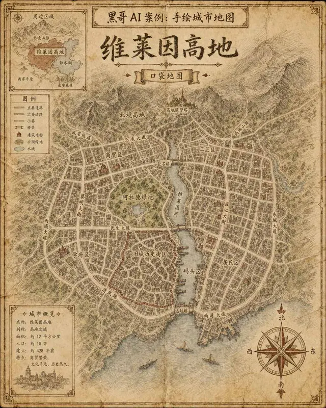
Hand-Drawn Fictional City Map
A hand-drawn city street map of the fictional municipality "Verlaine Heights", rendered as if sketched in brown ink on aged cream cartridge paper. Top-down orthographic view of a…
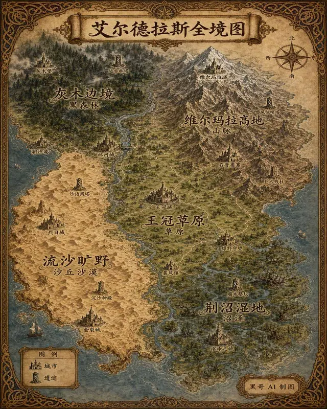
Illustrated Fantasy World Overview Map
A sweeping overview map of the fantasy continent "Aeldrath", painted in a classic fantasy atlas style with warm parchment tones. The continent spans most of the image, surrounded…
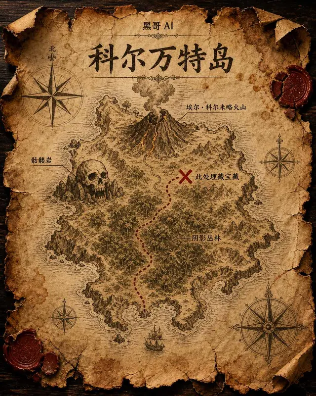
Treasure Island Parchment Map
A worn parchment treasure map of the fictional island "Isla de Corvante", rendered with aged sepia ink on crinkled vellum. The island's irregular coastline is drawn with careful h…

Illustrated Neighborhood Food Guide Map
A charming illustrated food guide map of the fictional "Brindlewick Quarter", rendered in a bright flat-illustration style with pastel fills and crisp black outlines. The bird's-e…