Ancient Nautical Chart Portolan
This is a Maps & Cartography AI image prompt case, leaning toward Vintage, Renaissance. Copy the full prompt below and paste it into a free GPT image generator to create your own image with GPT Image-2 — swap the subject, brand, or aspect ratio as needed.
English full prompt
A renaissance-era portolan-style nautical chart of a fictional inland sea, painted on aged vellum. Coastlines are drawn with meticulous quill linework, sprouting clusters of harbor-name labels that run perpendicular to the shore in tiny gothic capitals such as "PORT MERIDOLA", "ARGENTINE STRAIT", and "CAPE OF VESPERS". Sixteen rhumb lines radiate from two compass roses with golden fleur-de-lis tips and crimson points, crossing the chart in elegant geometric webs. Ship routes are inked in cinnabar dashes. A scale bar in leagues sits at the bottom-right. Decorative galleons sail in mid-sea, leaving curled wake lines, while a finned leviathan rises in the eastern waters next to a tiny mermaid. Land masses bear gilded city icons and a coat of arms shaped like a winged anchor. The vellum has visible cockling, an oxidized patina, and a torn edge revealing layered fibers. Palette: bone white, sepia, gilt gold, vermilion, lapis blue, and oak brown. Lighting is soft and even, as if photographed under a museum case with conservation glass.
中文完整提示词
文艺复兴时期波尔托兰风格的虚构内海航海图,绘制在陈旧羊皮纸上。海岸线以精致鹅毛笔线条勾勒,港口名密密麻麻垂直岸线书写,使用小型哥特大写字体,如 「PORT MERIDOLA」、「ARGENTINE STRAIT」、「CAPE OF VESPERS」。十六条恒向线从两枚带金色鸢尾尖端与朱红方位点的风玫瑰罗盘发散,构成几何蛛网。航线以朱砂虚线绘制。右下角是里格比例尺。海中绘有装饰性大帆船,留下卷曲航迹,东部水域一只带鳍利维坦浮出,旁有微小美人鱼。陆地标有镀金城市图标与展翅锚形纹章。羊皮纸有可见皱褶、氧化包浆,撕边露出层叠纤维。色调:骨白、深褐、鎏金、朱红、青金蓝、橡棕。光线柔和均匀,仿若博物馆护展玻璃下拍摄。
Related cases
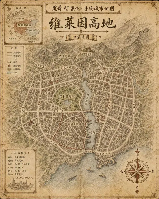
Hand-Drawn Fictional City Map
A hand-drawn city street map of the fictional municipality "Verlaine Heights", rendered as if sketched in brown ink on aged cream cartridge paper. Top-down orthographic view of a…

Neon Dark-Mode Subway Diagram
A clean transit diagram for the fictional underground network of "Orveka City", displayed on a near-black (#0d0d14) background. Twelve colour-coded lines arc and intersect across…
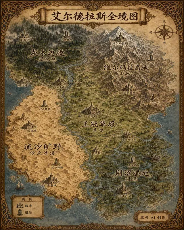
Illustrated Fantasy World Overview Map
A sweeping overview map of the fantasy continent "Aeldrath", painted in a classic fantasy atlas style with warm parchment tones. The continent spans most of the image, surrounded…
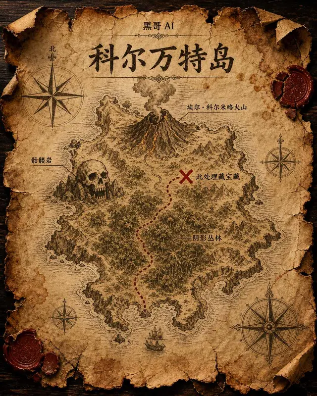
Treasure Island Parchment Map
A worn parchment treasure map of the fictional island "Isla de Corvante", rendered with aged sepia ink on crinkled vellum. The island's irregular coastline is drawn with careful h…