Soft Watercolor Regional Map
This is a Maps & Cartography AI image prompt case, leaning toward Watercolor, Vintage, Pastel. Copy the full prompt below and paste it into a free GPT image generator to create your own image with GPT Image-2 — swap the subject, brand, or aspect ratio as needed.
English full prompt
A soft, luminous watercolor regional map of the fictional lake district "Mirebell Lakes", painted in the manner of a high-quality illustrated travel atlas. The landscape is dominated by interlocking lake shapes in layered cerulean and teal washes, bleeding softly into sage-green forest areas and pale lavender highland moors. Small illustrated village icons mark settlements: "Cravenwick", "Ossindell", "Loch Mirren Village", and "Thorngate". Roads are thin rust-red lines; walking paths are dotted olive. Mountains in the northeast are suggested with loose wet-on-wet brushwork in grey-blue. A hand-painted title cartouche in the upper corner reads "Mirebell Lakes District" in a calligraphic brush script. The watercolor washes freely overstep the fine ink outlines, giving the map an intentionally imprecise, hand-crafted beauty. Paper texture is visible throughout. The mood is tranquil, pastoral, and quietly inviting.
中文完整提示词
虚构湖区「Mirebell Lakes」的柔和水彩区域地图,以高品质插画旅游地图集风格绘制。湖泊形态以蓝绿水洗层叠呈现,自然晕染至鼠尾草绿森林区与浅薰衣草高地荒原。村庄图标标注「Cravenwick」「Ossindell」「Loch Mirren Village」「Thorngate」,公路为细锈红线,步径为橄榄绿虚线。东北山脉以湿叠湿笔法的灰蓝色松散表现。左上角手绘标题装饰框以毛笔草书写「Mirebell Lakes District」,水彩自然越过墨线轮廓,呈现刻意不精准的手工美感,纸纹全程可见,整体氛围宁静田园。
Related cases
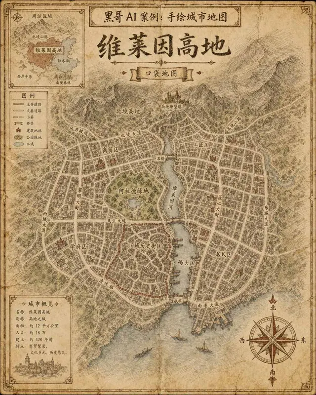
Hand-Drawn Fictional City Map
A hand-drawn city street map of the fictional municipality "Verlaine Heights", rendered as if sketched in brown ink on aged cream cartridge paper. Top-down orthographic view of a…

Neon Dark-Mode Subway Diagram
A clean transit diagram for the fictional underground network of "Orveka City", displayed on a near-black (#0d0d14) background. Twelve colour-coded lines arc and intersect across…
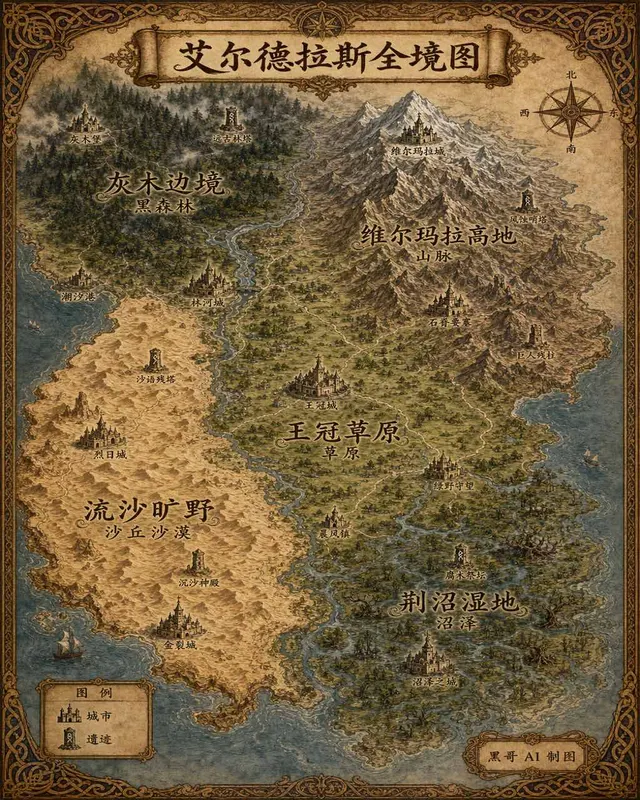
Illustrated Fantasy World Overview Map
A sweeping overview map of the fantasy continent "Aeldrath", painted in a classic fantasy atlas style with warm parchment tones. The continent spans most of the image, surrounded…
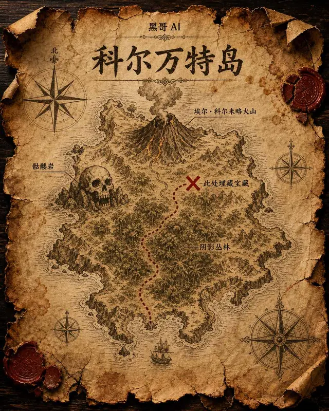
Treasure Island Parchment Map
A worn parchment treasure map of the fictional island "Isla de Corvante", rendered with aged sepia ink on crinkled vellum. The island's irregular coastline is drawn with careful h…