Mountain Region Topographic Map
This is a Maps & Cartography AI image prompt case, leaning toward Editorial, Minimalist. Copy the full prompt below and paste it into a free GPT image generator to create your own image with GPT Image-2 — swap the subject, brand, or aspect ratio as needed.
English full prompt
A clean editorial topographic map of a fictional alpine region called "Aldur Massif", top-down view. The composition is built from finely-spaced brown contour lines that flow in concentric curves over peaks and valleys, with every fifth line slightly thicker for readability. Elevation values appear as small italic numbers along the lines, ranging from 600 to 3,420 meters. Glaciers are subtle pale blue tints feathering into the highest contours, alpine lakes are filled in clean cyan with white shorelines, and forests are indicated by light olive shading. Hiking trails run as bold magenta dashes, with mountain huts marked as small black triangles labeled "Refuge Sentier", "Cabane d'Alba", and "Bivouac Korel". Three summits are crowned with little black cross icons and their names in small caps: "PIZ ALDUR", "PIC SEREL", and "AIGUILLE DE VRAN". A north arrow, a kilometer scale bar, and a coordinate grid frame the layout. The palette stays restrained: cream paper, sienna contours, alpine cyan, olive forest, and a single magenta accent. The result feels like a premium guidebook foldout designed for serious mountain enthusiasts.
中文完整提示词
一张干净的编辑级阿尔卑斯山区地形图,虚构区域名为 「Aldur Massif」,俯视构图。画面以细密褐色等高线构建,环绕山峰山谷流动,每五条加粗便于辨识。等高线沿线写有小斜体数字,海拔从 600 到 3,420 米。冰川以淡蓝色羽化至最高等高线,高山湖泊以纯青蓝填色配白色岸线,森林以淡橄榄阴影示意。徒步路径为粗品红虚线,山屋以小黑三角标注:「Refuge Sentier」、「Cabane d'Alba」、「Bivouac Korel」。三座山峰戴小黑十字图标,山名以小型大写呈现:「PIZ ALDUR」、「PIC SEREL」、「AIGUILLE DE VRAN」。指北箭头、公里比例尺和坐标网格构成框架。色调克制:奶纸、赭褐等高线、高山青蓝、橄榄森林,唯一品红点缀。整体如高端登山指南折页,专为资深登山爱好者设计。
Related cases
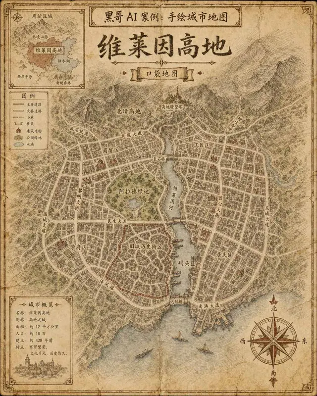
Hand-Drawn Fictional City Map
A hand-drawn city street map of the fictional municipality "Verlaine Heights", rendered as if sketched in brown ink on aged cream cartridge paper. Top-down orthographic view of a…

Neon Dark-Mode Subway Diagram
A clean transit diagram for the fictional underground network of "Orveka City", displayed on a near-black (#0d0d14) background. Twelve colour-coded lines arc and intersect across…
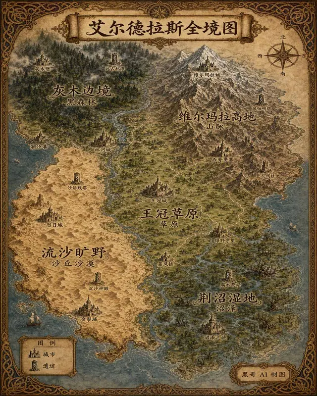
Illustrated Fantasy World Overview Map
A sweeping overview map of the fantasy continent "Aeldrath", painted in a classic fantasy atlas style with warm parchment tones. The continent spans most of the image, surrounded…
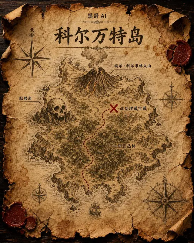
Treasure Island Parchment Map
A worn parchment treasure map of the fictional island "Isla de Corvante", rendered with aged sepia ink on crinkled vellum. The island's irregular coastline is drawn with careful h…