Infographic Country Population Map
This is a Maps & Cartography AI image prompt case, leaning toward Flat, Minimalist, Geometric. Copy the full prompt below and paste it into a free GPT image generator to create your own image with GPT Image-2 — swap the subject, brand, or aspect ratio as needed.
English full prompt
An infographic-style population distribution map of the fictional country "Valdosia", rendered in a clean data-journalism aesthetic. The country's administrative regions are shown as flat filled polygons, coloured on a sequential choropleth scale from pale sand (low density) through warm orange to deep burgundy (high density), with a smooth five-step gradient legend. Each region is labelled with its name and population figure in a compact sans-serif (e.g., "Karevna Province — 2.4M", "Delthorpe Region — 0.8M"). A set of proportional circle overlays on the three largest cities — "Caldenmere", "Vossport", and "Sundreach" — shows metro area populations as scaled pink circles. Small bar charts beside each city give demographic age breakdown. The title "Valdosia: Population Distribution 2040" is set in a bold condensed sans-serif. A source line, projection note, and scale bar are included. The palette is restrained: sand, burnt orange, burgundy, and neutral grey on white.
中文完整提示词
虚构国家「Valdosia」的信息图表风人口分布地图,呈现清洁数据新闻美学。行政区域以扁平多边形呈现,按顺序色阶从浅沙色(低密度)渐变至深勃艮第红(高密度),五级渐变图例。每个区域标注名称与人口数字(如「Karevna Province — 2.4M」「Delthorpe Region — 0.8M」)。三大城市「Caldenmere」「Vossport」「Sundreach」叠加比例圆形显示都会区人口,旁附小条形图显示年龄人口结构。标题「Valdosia: Population Distribution 2040」以粗体压缩无衬线字体呈现,包含数据来源、投影说明与比例尺。
Related cases
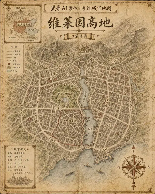
Hand-Drawn Fictional City Map
A hand-drawn city street map of the fictional municipality "Verlaine Heights", rendered as if sketched in brown ink on aged cream cartridge paper. Top-down orthographic view of a…

Neon Dark-Mode Subway Diagram
A clean transit diagram for the fictional underground network of "Orveka City", displayed on a near-black (#0d0d14) background. Twelve colour-coded lines arc and intersect across…
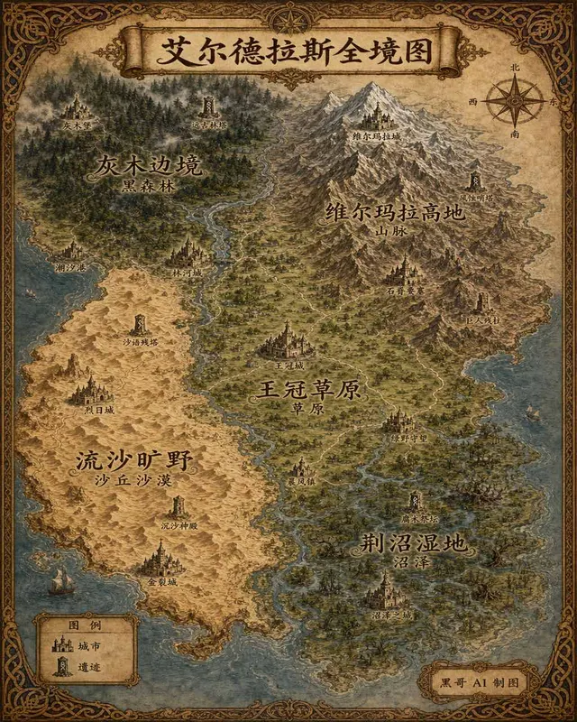
Illustrated Fantasy World Overview Map
A sweeping overview map of the fantasy continent "Aeldrath", painted in a classic fantasy atlas style with warm parchment tones. The continent spans most of the image, surrounded…
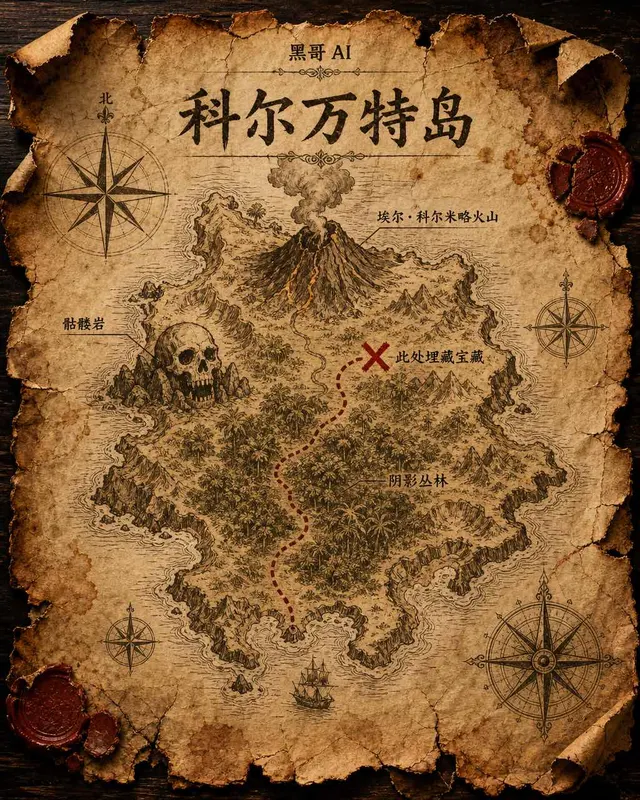
Treasure Island Parchment Map
A worn parchment treasure map of the fictional island "Isla de Corvante", rendered with aged sepia ink on crinkled vellum. The island's irregular coastline is drawn with careful h…