Ancient Portolan-Style Maritime Chart
English full prompt
A faithful recreation of a 14th-century portolan chart depicting the fictional "Mare Torcello" sea and surrounding coastlines, rendered on simulated vellum with a warm honey-yellow tint. The characteristic web of rhumb lines (wind roses radiating from multiple hidden circles) crisscrosses the entire chart in fine gold and red ink. Coastlines are drawn in precise, slightly wiggly ink strokes with hundreds of tiny port names written perpendicular to the shore in black and red gothic lettering — red for major ports like "Varenna" and "Porto Sereno", black for minor anchorages. Islands are filled with solid colour washes (green for inhabited, buff for barren). Decorative elements include a detailed wind rose in the centre, a galleon illustration in open water, and a vignette of sea monsters near the chart's equator. The overall palette is aged amber, sienna, forest green, and faded crimson on vellum texture.
中文完整提示词
14世纪风格的「Mare Torcello」虚构海域航海图,绘于模拟牛皮纸上,呈现蜜黄色泽。细密的罗盘方位线以金色与红色墨水覆盖全图,海岸线以略弯曲的精细墨线绘制,港口名以哥特字体垂直海岸标注,主要港口「Varenna」「Porto Sereno」用红色,次要锚地用黑色。岛屿填以纯色水洗,中央绘有精细风玫瑰,开放海域有帆船插图,赤道附近有海怪装饰,整体色调为陈年琥珀、赭石、森林绿与褪色深红。
Related cases
-
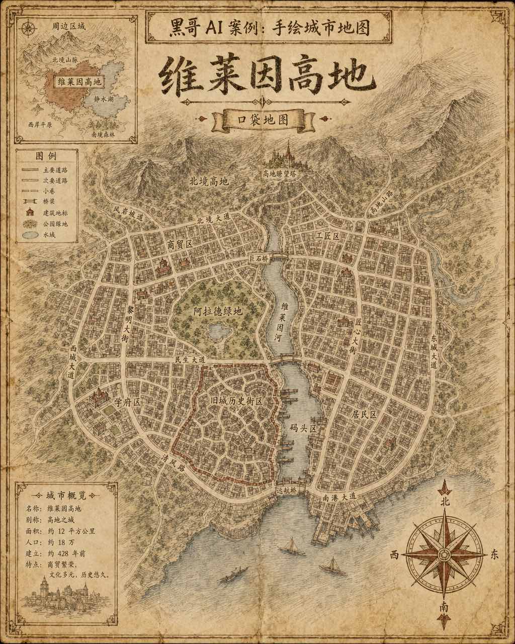
Hand-Drawn Fictional City Map
A hand-drawn city street map of the fictional municipality "Verlaine Heights", rendered as if sketched in brown ink on aged cream cartridge paper. Top-down orthographic view of a…
-

Neon Dark-Mode Subway Diagram
A clean transit diagram for the fictional underground network of "Orveka City", displayed on a near-black (#0d0d14) background. Twelve colour-coded lines arc and intersect across…
-
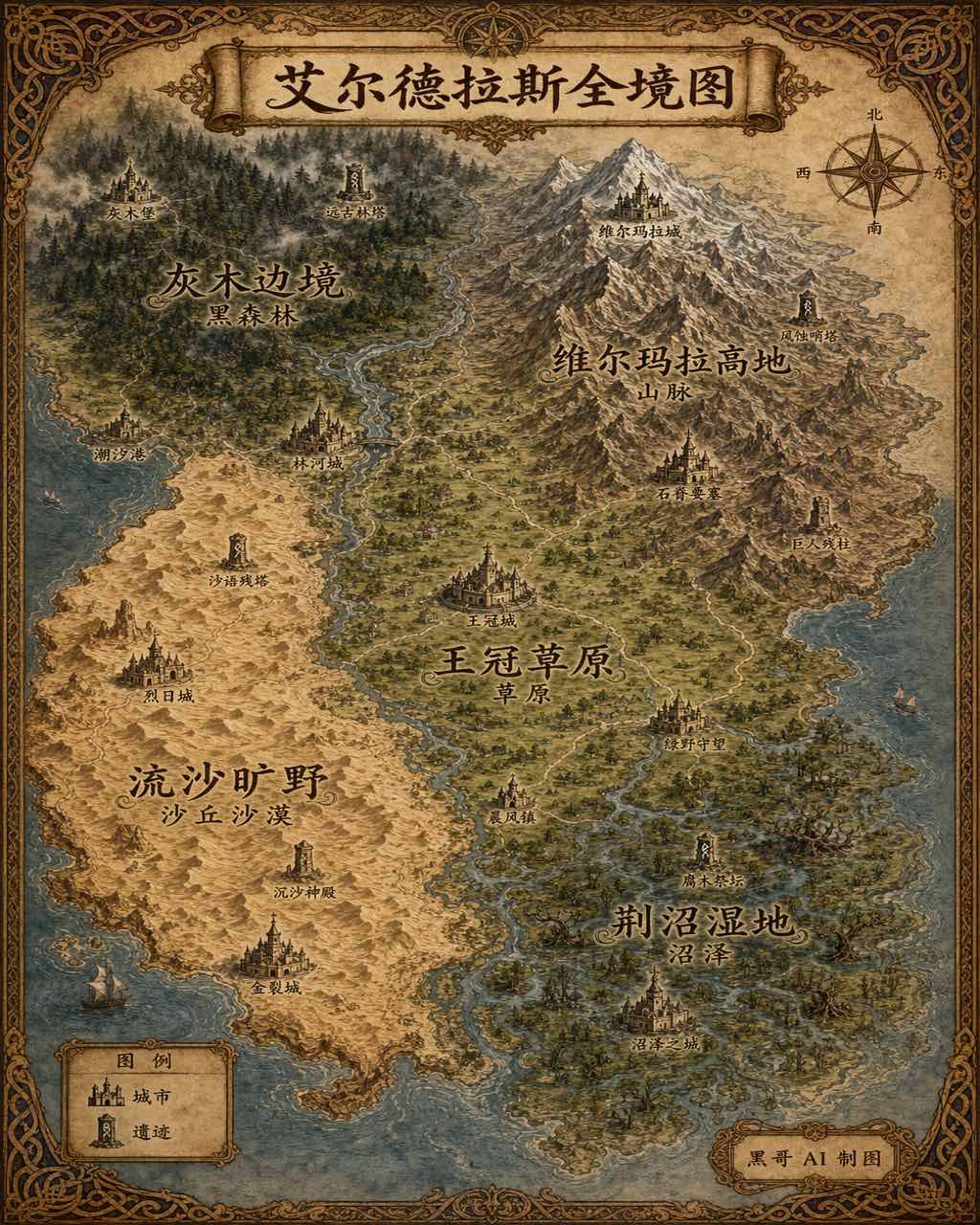
Illustrated Fantasy World Overview Map
A sweeping overview map of the fantasy continent "Aeldrath", painted in a classic fantasy atlas style with warm parchment tones. The continent spans most of the image, surrounded…
-
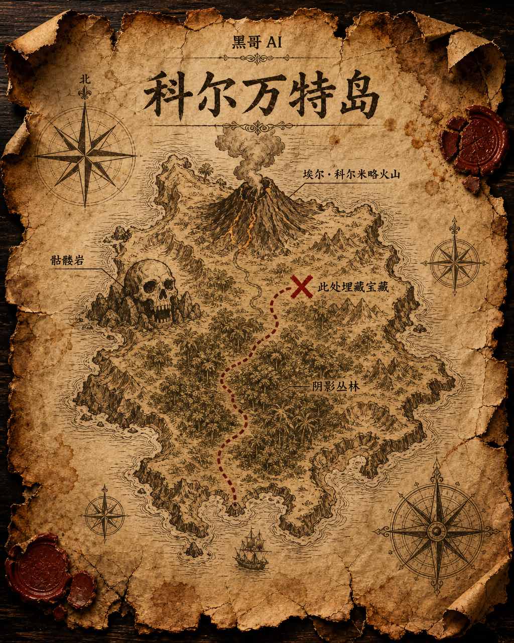
Treasure Island Parchment Map
A worn parchment treasure map of the fictional island "Isla de Corvante", rendered with aged sepia ink on crinkled vellum. The island's irregular coastline is drawn with careful h…