Editorial Storm-System Weather Map
English full prompt
An editorial-style weather map depicting a powerful fictional cyclone system labelled "Tempest Omega" over a stylised ocean basin. The basemap is a flat projection with muted slate-blue ocean and light-grey land masses, simplified continental outlines. The storm system is rendered with concentric isobar rings (fine white lines), a central low-pressure marker ("L"), and spiralling cloud bands visualised as translucent white swoops. A colour-gradient rainfall overlay uses a cool-to-warm palette: pale lavender for light rain through to deep indigo and crimson for extreme precipitation bands. Wind-barb symbols indicate wind direction and speed at grid points. Forecast track arrows in bold orange show the projected path labelled with dates. A clean legend on the right side explains the colour scale in millimetres of rainfall. Temperature anomaly contours appear in dashed red and blue. The typography is tight, functional, and sans-serif — matching the aesthetic of a serious news organisation's meteorology graphic. 中文完整提示词
描绘虚构气旋系统「Tempest Omega」的编辑风暴天气地图,覆盖风格化海洋盆地。底图为扁平投影,哑光板岩蓝海洋与浅灰陆块,简化大陆轮廓。风暴系统以同心等压线(细白线)与中心低压标记「L」呈现,云带为半透明白色涡旋。降雨叠加层从浅薰衣草渐变至深靛蓝与深红。风标符号标示各格点风向风速,橙色粗箭头预报路径标注日期。右侧图例说明降雨量颜色比例,温度异常以红蓝虚线轮廓表示,排版紧凑功能性,呈现严肃新闻气象图表美学。
Related cases
-
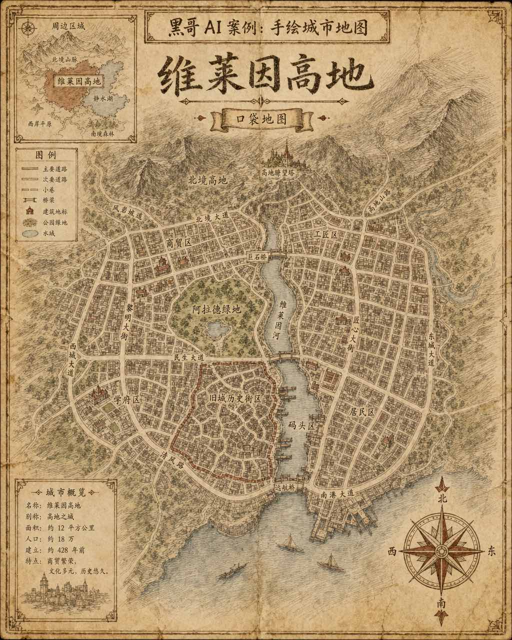
Hand-Drawn Fictional City Map
A hand-drawn city street map of the fictional municipality "Verlaine Heights", rendered as if sketched in brown ink on aged cream cartridge paper. Top-down orthographic view of a…
-

Neon Dark-Mode Subway Diagram
A clean transit diagram for the fictional underground network of "Orveka City", displayed on a near-black (#0d0d14) background. Twelve colour-coded lines arc and intersect across…
-
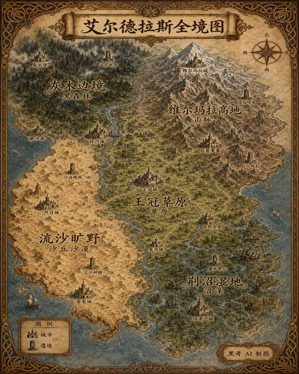
Illustrated Fantasy World Overview Map
A sweeping overview map of the fantasy continent "Aeldrath", painted in a classic fantasy atlas style with warm parchment tones. The continent spans most of the image, surrounded…
-
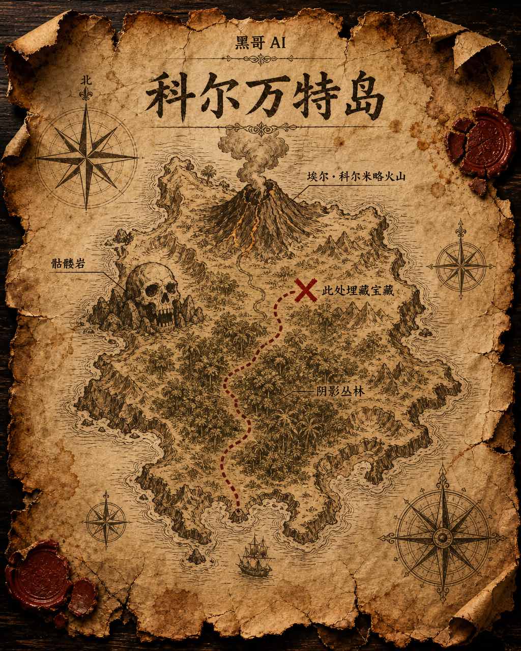
Treasure Island Parchment Map
A worn parchment treasure map of the fictional island "Isla de Corvante", rendered with aged sepia ink on crinkled vellum. The island's irregular coastline is drawn with careful h…