编辑风暴天气系统地图
中文完整提示词
描绘虚构气旋系统「Tempest Omega」的编辑风暴天气地图,覆盖风格化海洋盆地。底图为扁平投影,哑光板岩蓝海洋与浅灰陆块,简化大陆轮廓。风暴系统以同心等压线(细白线)与中心低压标记「L」呈现,云带为半透明白色涡旋。降雨叠加层从浅薰衣草渐变至深靛蓝与深红。风标符号标示各格点风向风速,橙色粗箭头预报路径标注日期。右侧图例说明降雨量颜色比例,温度异常以红蓝虚线轮廓表示,排版紧凑功能性,呈现严肃新闻气象图表美学。
English full prompt
An editorial-style weather map depicting a powerful fictional cyclone system labelled "Tempest Omega" over a stylised ocean basin. The basemap is a flat projection with muted slate-blue ocean and light-grey land masses, simplified continental outlines. The storm system is rendered with concentric isobar rings (fine white lines), a central low-pressure marker ("L"), and spiralling cloud bands visualised as translucent white swoops. A colour-gradient rainfall overlay uses a cool-to-warm palette: pale lavender for light rain through to deep indigo and crimson for extreme precipitation bands. Wind-barb symbols indicate wind direction and speed at grid points. Forecast track arrows in bold orange show the projected path labelled with dates. A clean legend on the right side explains the colour scale in millimetres of rainfall. Temperature anomaly contours appear in dashed red and blue. The typography is tight, functional, and sans-serif — matching the aesthetic of a serious news organisation's meteorology graphic. 相关案例
-
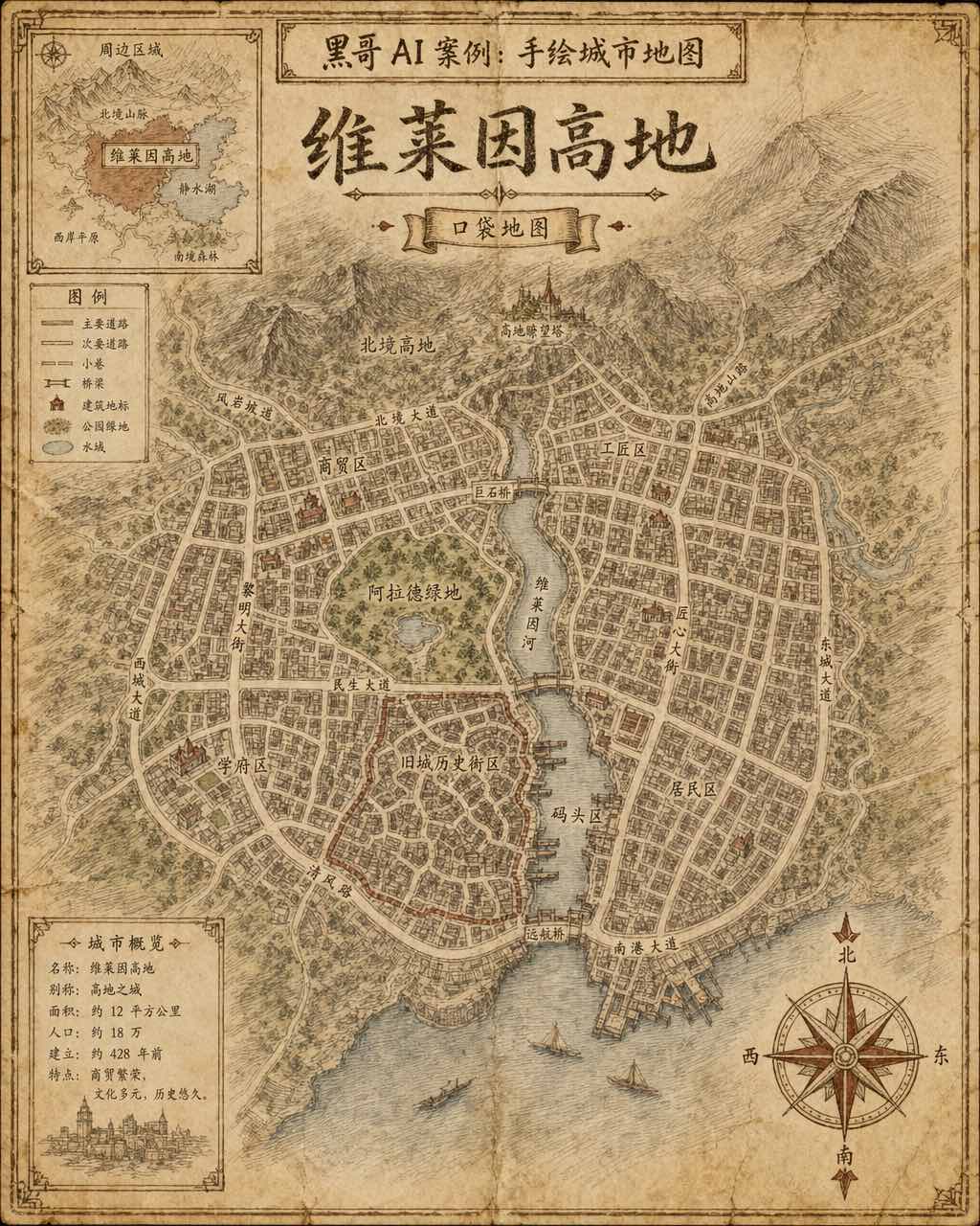
手绘虚构城市地图
一张虚构城市「Verlaine Heights」的手绘街道地图,以棕色墨水绘于泛黄奶油色绘图纸上,俯视正交视角。密集的街道网格、一条将城市一分为二的河流、中央公园标注为「Allard Green」,以及蜿蜒的历史街区。街道名以略显不规则的衬线手写体标注,右下角绘有装饰性罗盘玫瑰,左上角有显示周边区域的小插图。铅笔排线…
-

霓虹深色地铁线路图
虚构城市「Orveka City」地下网络的简洁线路示意图,背景为近黑色(#0d0d14)。十二条彩色线路以45度角弧线交织,包括荧光绿、霓虹珊瑚红、天蓝、琥珀、紫罗兰等。站点为白色圆点,换乘站为多环标记。站名以紧凑无衬线字体显示,带轻微辉光效果。图例列出「Cerulean Line」「Amber Line」「Van…
-
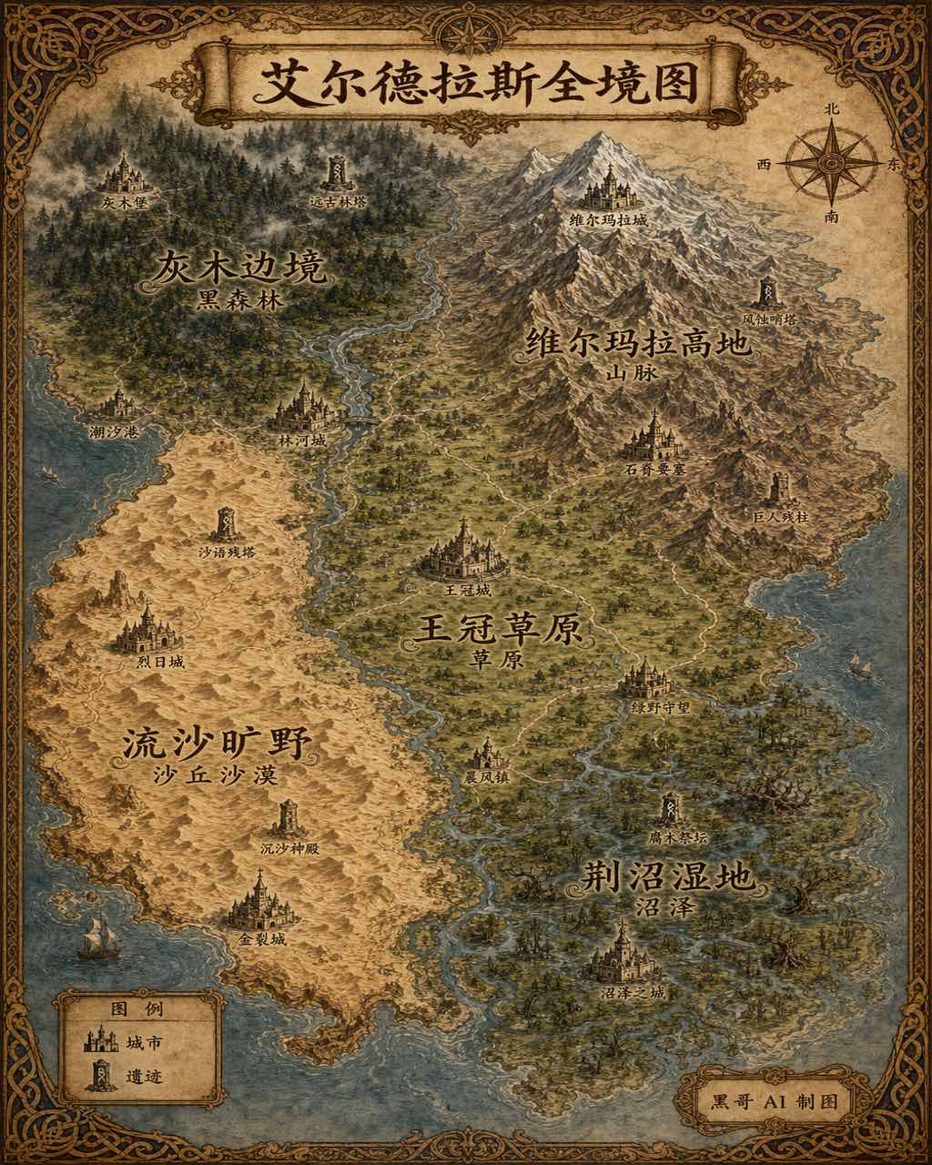
插画风奇幻世界全览地图
生成一张 4:5 竖版「插画风奇幻世界全览地图」案例图,所属分类为「地图与制图」。奇幻大陆地图,羊皮纸背景,各区域彩绘、城堡图标与花体地名。画面需要完整呈现上述主体、构图、配色、材质、光线和整体风格;可见文字以自然简体中文为主,必要的技术缩写、代码、变量名、学术符号、单位、拉丁物种名或装饰性外文可保留。
-
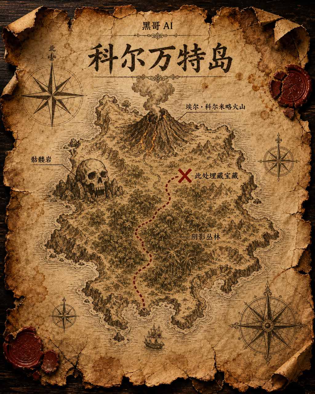
藏宝岛羊皮纸地图
虚构岛屿「Isla de Corvante」的磨损羊皮纸藏宝图,以泛黄墨水绘于皱折牛皮纸上。海岸线用细致排线描绘,内陆有火山「El Colmillo」、丛林「Selva Sombría」、骷髅岩「Peñasco Calavera」,以及标注「Aquí yace el tesoro」的X宝藏位置。虚线小径从南岸海湾穿越…