插画风国家公园步道地图
中文完整提示词
一张受 WPA 海报启发的复古插画国家公园地图,公园名为 「Pine Hollow National Park」,三分之四俯视。起伏山丘由松绿、鼠尾草绿、灰陶土色的扁平色块层叠而成。蜿蜒河流绕过青蓝色冰川湖 「Mirror Tarn」。五条彩色步道从中央护林员站发散:绿色简易、蓝色中等、红色高难、紫色野外、黄色无障碍。步道标牌标英里里程。图标显示黑熊草甸、瞭望火塔、蝙蝠栖洞穴、带木桥的瀑布和观星草甸。前景下方以两棵松树框景。顶部粗板衬线字写着 「Pine Hollow National Park」,副标 「Established 1932」。左下图例列出步道难度、水源、洗手间和露营。复古配色:奶白、森绿、赭石、砖红、石板。整体淡纸纹,山丘有半色调点纹理,标题下有柔阴影。
English full prompt
A retro WPA-poster-inspired illustrated map of a fictional national park called "Pine Hollow National Park", three-quarter top-down view. Rolling hills are layered in flat shapes of pine, sage, and dusty terracotta. A meandering river loops past a teal kettle lake labeled "Mirror Tarn". Five color-coded trails fan out from a central ranger station: green for easy, blue for moderate, red for strenuous, purple for backcountry, and yellow for ADA-accessible. Trail markers show distances in miles. Icons indicate a black-bear meadow, a fire-watch tower, a bat-roost cave, a waterfall with a small wooden footbridge, and a star-gazing meadow. A pair of pine trees frames the lower foreground. The title "Pine Hollow National Park" appears in chunky slab-serif letters across the top, with the subtitle "Established 1932". A legend in the lower-left lists trail difficulty, water sources, restrooms, and camping. Muted retro palette: cream, forest, ochre, brick, and slate. Subtle paper grain throughout, slight halftone dot shading on hills, and a soft drop shadow under the title.
相关案例
-
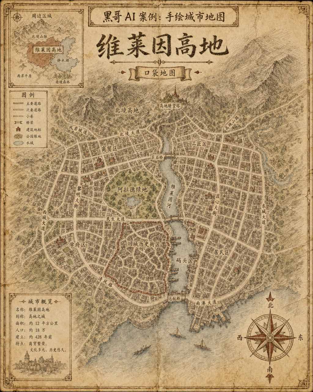
手绘虚构城市地图
一张虚构城市「Verlaine Heights」的手绘街道地图,以棕色墨水绘于泛黄奶油色绘图纸上,俯视正交视角。密集的街道网格、一条将城市一分为二的河流、中央公园标注为「Allard Green」,以及蜿蜒的历史街区。街道名以略显不规则的衬线手写体标注,右下角绘有装饰性罗盘玫瑰,左上角有显示周边区域的小插图。铅笔排线…
-

霓虹深色地铁线路图
虚构城市「Orveka City」地下网络的简洁线路示意图,背景为近黑色(#0d0d14)。十二条彩色线路以45度角弧线交织,包括荧光绿、霓虹珊瑚红、天蓝、琥珀、紫罗兰等。站点为白色圆点,换乘站为多环标记。站名以紧凑无衬线字体显示,带轻微辉光效果。图例列出「Cerulean Line」「Amber Line」「Van…
-
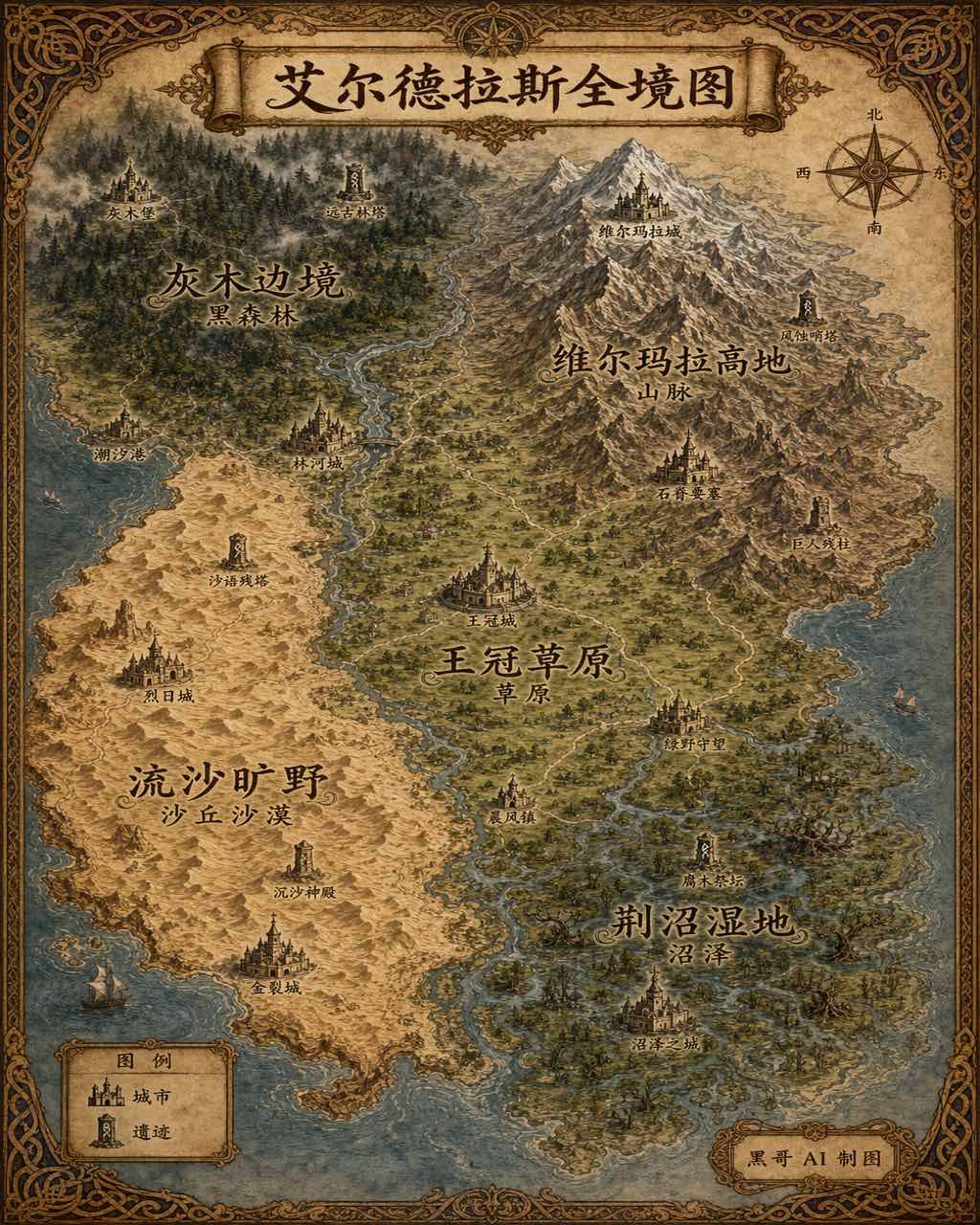
插画风奇幻世界全览地图
生成一张 4:5 竖版「插画风奇幻世界全览地图」案例图,所属分类为「地图与制图」。奇幻大陆地图,羊皮纸背景,各区域彩绘、城堡图标与花体地名。画面需要完整呈现上述主体、构图、配色、材质、光线和整体风格;可见文字以自然简体中文为主,必要的技术缩写、代码、变量名、学术符号、单位、拉丁物种名或装饰性外文可保留。
-
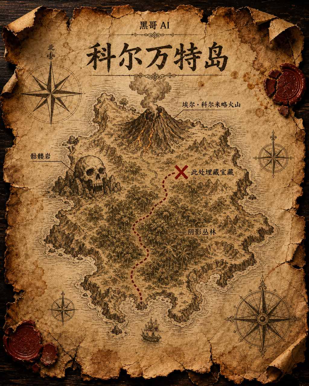
藏宝岛羊皮纸地图
虚构岛屿「Isla de Corvante」的磨损羊皮纸藏宝图,以泛黄墨水绘于皱折牛皮纸上。海岸线用细致排线描绘,内陆有火山「El Colmillo」、丛林「Selva Sombría」、骷髅岩「Peñasco Calavera」,以及标注「Aquí yace el tesoro」的X宝藏位置。虚线小径从南岸海湾穿越…