Geological Sedimentary Cross-Section
English full prompt
A wide landscape-format geological cross-section diagram showing roughly 1200 metres of sedimentary stratigraphy in the style of a field geology textbook plate. The surface topography at the top is a gently undulating brown line with sparse stylised tree and grass symbols. Below, horizontal to gently dipping rock strata are drawn with characteristic texture fills: the uppermost unit is a sandy limestone in pale buff with small dot pattern; beneath it, a dark grey shale layer with fine horizontal hatch marks; then a red-brown mudstone with diagonal dashes; then a coal seam in solid black with a thin 0.5 m scale tick; then a conglomerate in grey with circular pebble symbols; and at the base, a dark basement granite with cross-hatch plus granite speckle. A normal fault runs diagonally through the right third of the section, displacing layers by approximately 80 m, shown as a bold black line with dip-slip arrows. An anticline fold structure appears in the left third. Vertical depth scale bar on the right: 0 to 1200 m with 200 m intervals. A legend panel at bottom-left identifies each unit. Colour palette: earthy buff, grey, dark brown, black, crimson, slate. White background. Thin line weight with high precision.
中文完整提示词
一张横向地质剖面图,约 1200 米沉积地层剖面,地质教科书图版风格。地表为褐色起伏线,带程式化树草符号。地层从上至下:淡黄灰砂质石灰岩(点状填充)、深灰页岩(细横排线)、红棕色泥岩(斜线填充)、实黑煤层(含 0.5m 刻度尺)、灰色砾岩(圆卵石符号)、底部深色基底花岗岩(交叉线+花岗岩斑点)。右三分之一处正断层斜贯,垂直位移约 80m;左三分之一处背斜褶皱。右侧深度刻度条 0–1200m(200m 间隔)。左下角图例。土黄、灰、深棕、黑、深红、石板色系,白色背景,细线高精度风格。
Related cases
-
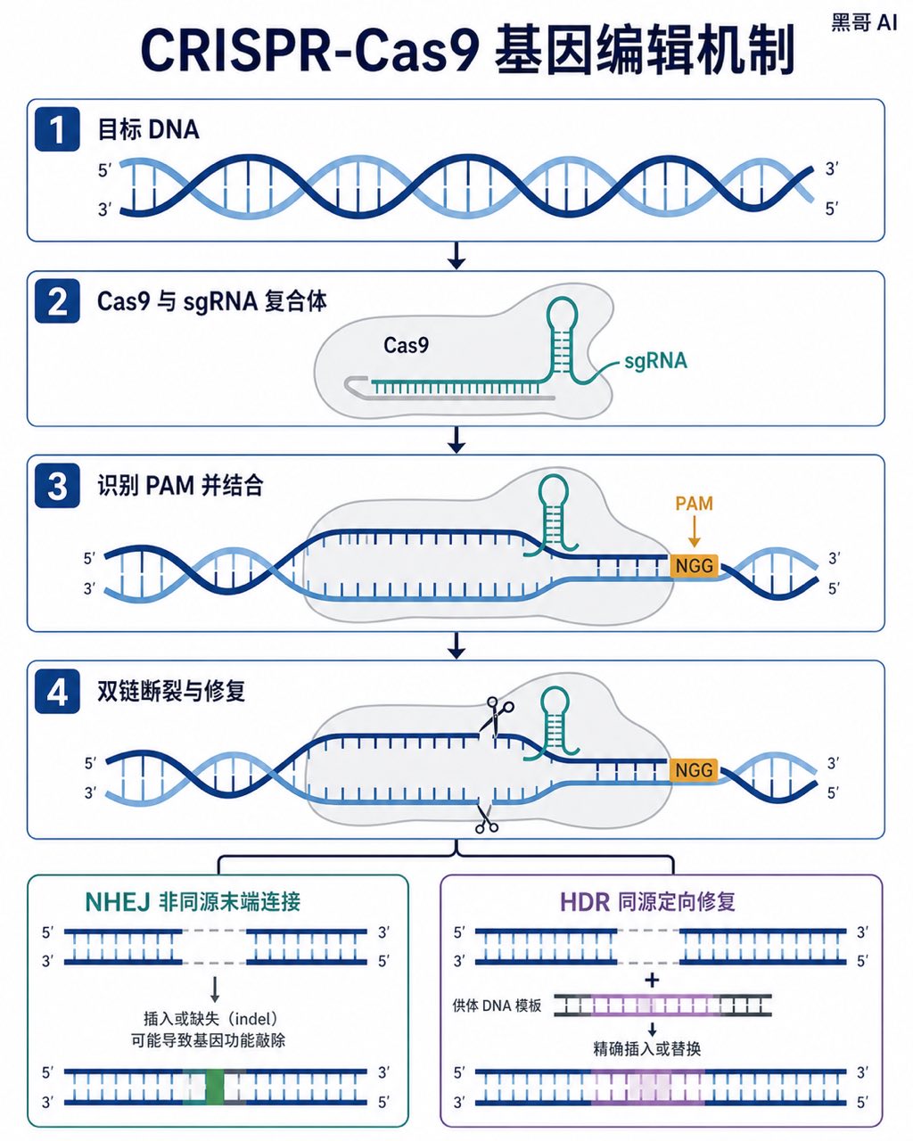
CRISPR-Cas9 Gene Editing Mechanism
A Nature-journal-quality flat vector diagram illustrating the CRISPR-Cas9 gene-editing mechanism. The composition is horizontal, spanning roughly A4 landscape, divided into four s…
-
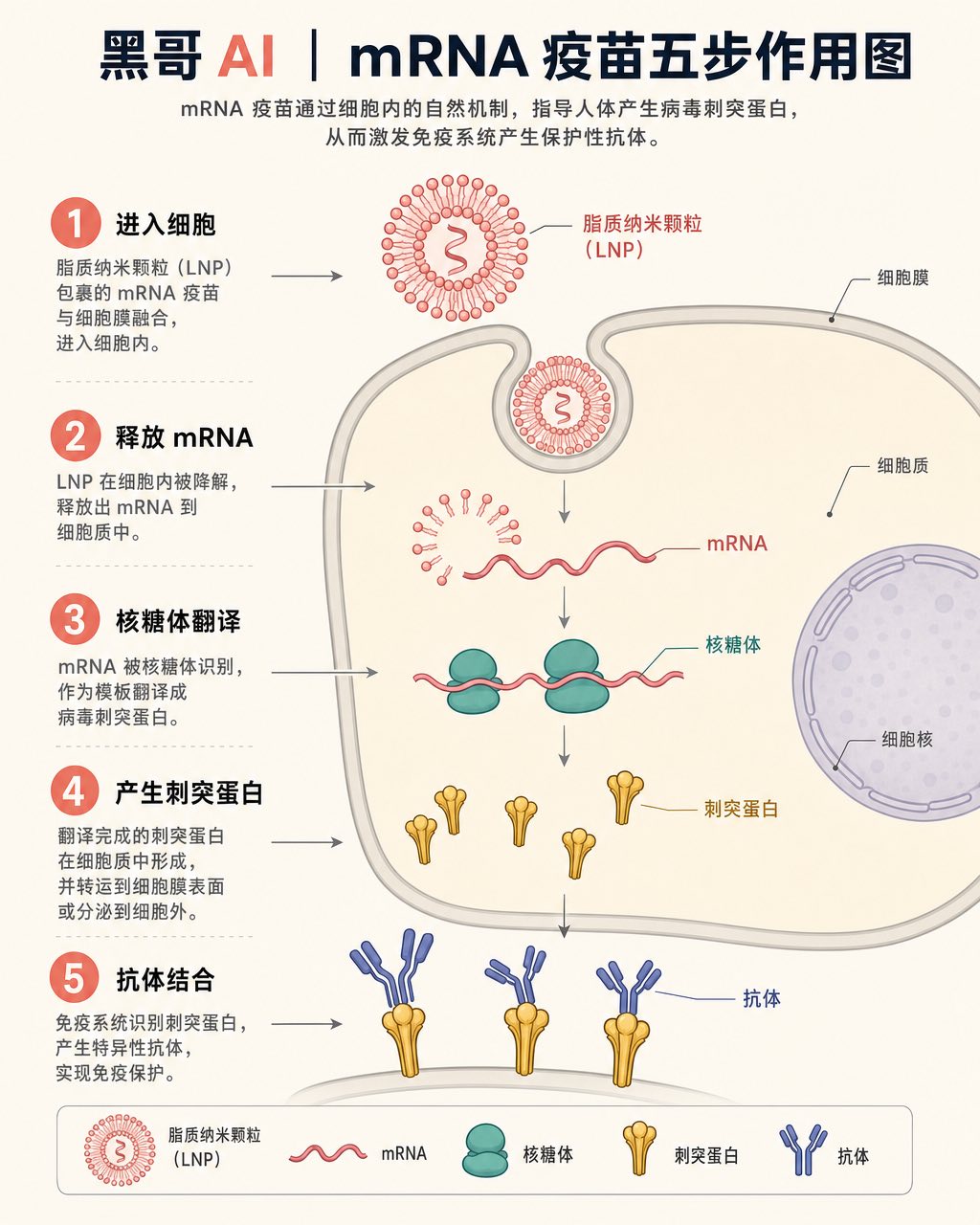
mRNA Vaccine Cellular Action
A textbook-flat isometric infographic showing the step-by-step action of an mRNA vaccine inside a human cell. The scene is rendered in a soft clinical palette: off-white backgroun…
-
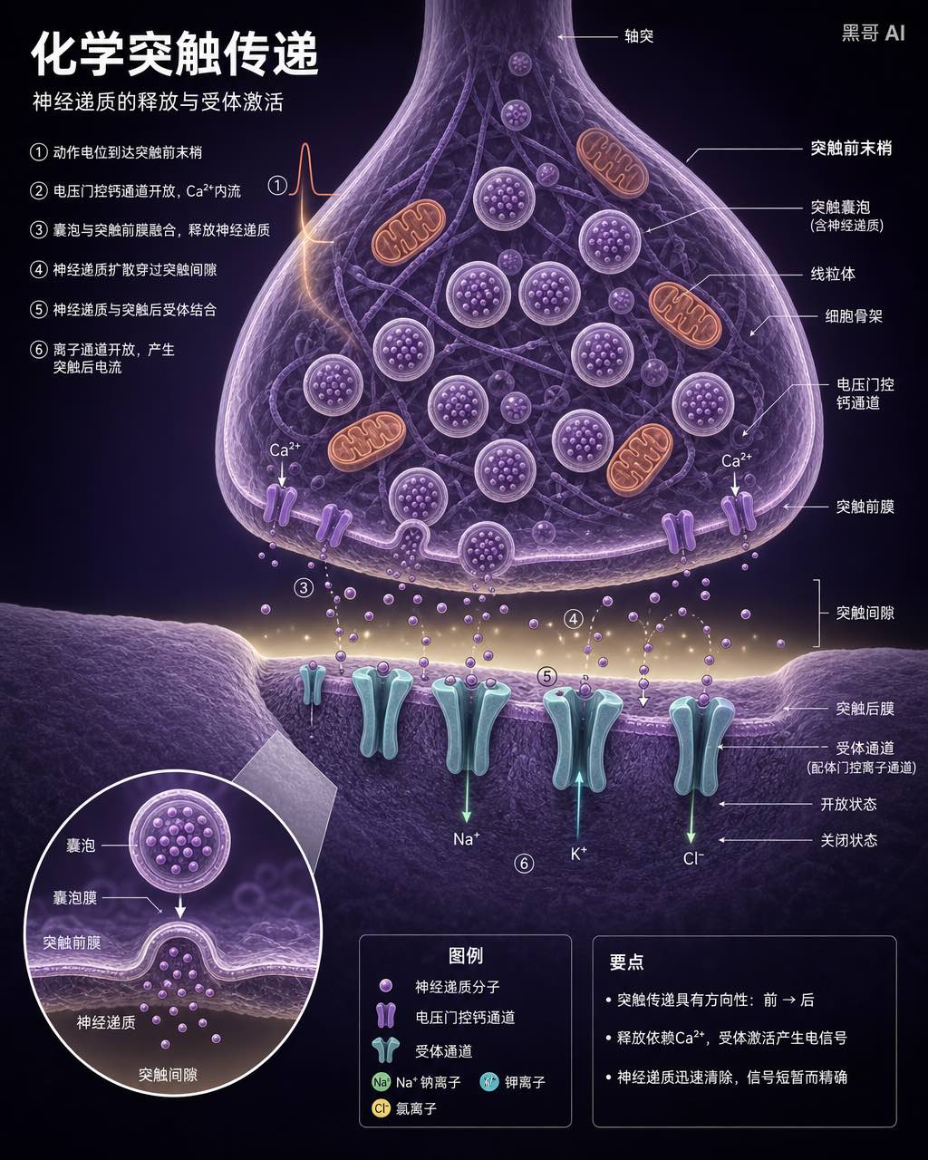
Neuron Synapse Cross-Section
A precise anatomical cross-section illustration of a chemical synapse between two neurons, rendered in the style of a high-end neuroscience textbook. Viewpoint: close-up transvers…
-
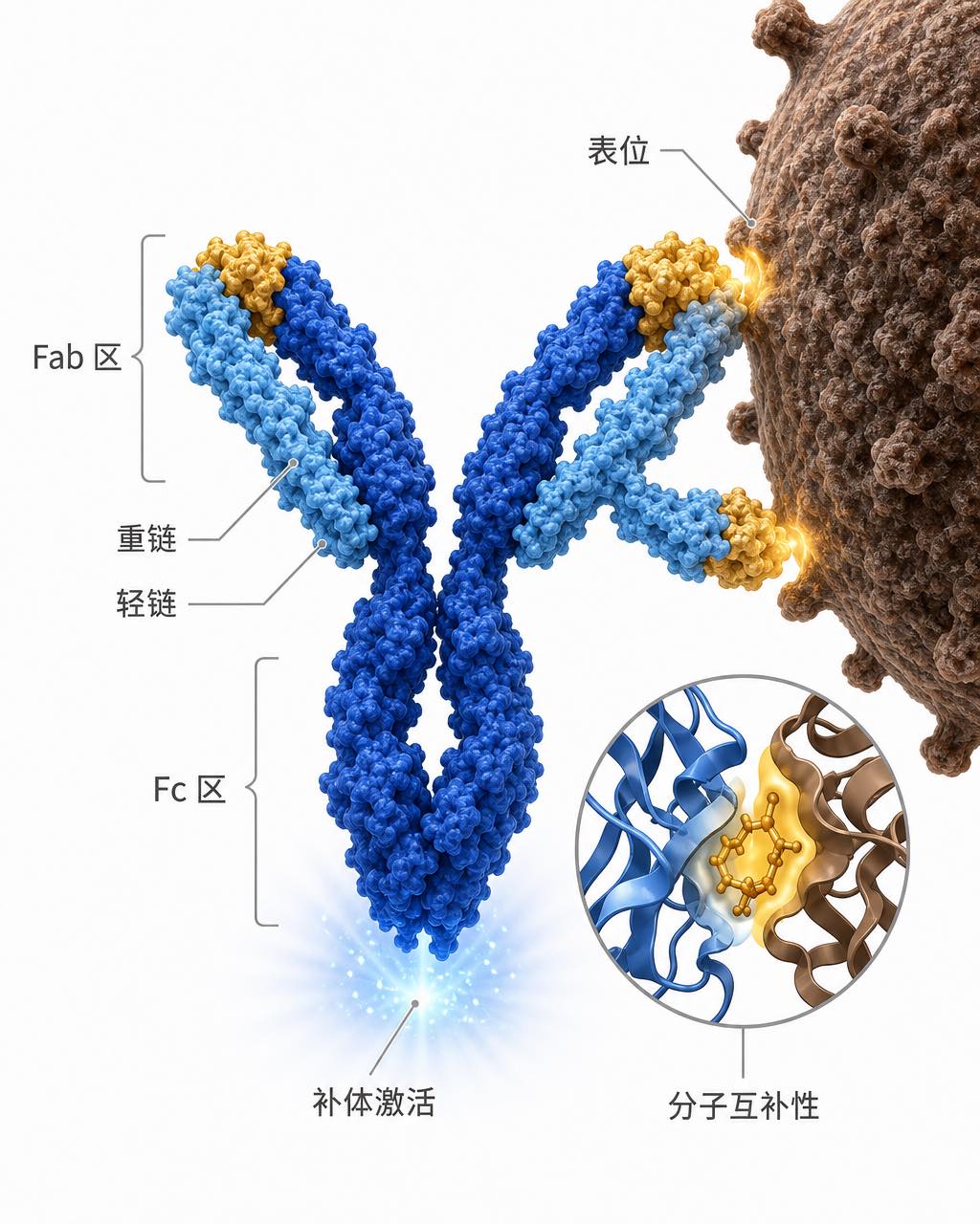
Antibody-Antigen Binding Diagram
A clean scientific illustration of an IgG antibody binding to a surface antigen on a pathogen, suitable for an immunology lecture slide. The antibody is rendered in a semi-3D ribb…