水彩登山步道地图
这是一个「地图与制图」类别的 AI 生图提示词案例,风格偏向水彩、线稿、复古旧感。复制下方完整提示词,打开免费 GPT 生图工具粘贴,即可用 GPT Image-2 免费出图,并可替换主体、品牌名与画幅。
中文完整提示词
虚构荒野区「Cinderfall Peaks」的手绘水彩登山步道地图。蓝灰色水洗表现山体,苔绿色标示低海拔森林区,暖赭色描绘裸露山脊线。主步道以红色虚线标注,从入口「Ember Gate」经「Whistler Saddle」、「Black Tarn」到「Summit Cairn」,各节点附手绘圈与海拔注记。陶土色轮廓线增添地形层次,图例标示营地、庇护所、水源与观景点,比例尺与北箭头以淡墨标注,水彩边缘自然晕染呈现写生质感。
English full prompt
A hand-painted watercolor hiking trail map of the fictional "Cinderfall Peaks" wilderness area. Soft washes of blue-grey for the mountain massif, mossy green for lower forest zones, and warm ochre for exposed rocky ridgelines. The primary trail is drawn as a dashed red line snaking from the trailhead "Ember Gate" through three waypoints — "Whistler Saddle", "Black Tarn", and "Summit Cairn" — each marked with a hand-drawn circle and elevation annotation. Contour lines in a faint terracotta ink add topographic depth. Illustrated pictograms indicate camping spots (tent), emergency shelters (triangle), water sources (drop), and viewpoints (eye). Scale bar and north arrow are lightly inked at the base. Distance markers appear at 1 km intervals. The watercolor bleeds softly at edges, giving an organic, plein-air feel. Typography is a clean condensed sans-serif for legibility against the painted background.
相关案例
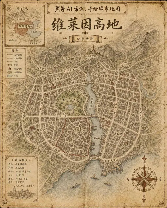
手绘虚构城市地图
一张虚构城市「Verlaine Heights」的手绘街道地图,以棕色墨水绘于泛黄奶油色绘图纸上,俯视正交视角。密集的街道网格、一条将城市一分为二的河流、中央公园标注为「Allard Green」,以及蜿蜒的历史街区。街道名以略显不规则的衬线手写体标注,右下角绘有装饰性罗盘玫瑰,左上角有显示周边区域的小插图。铅笔排线…
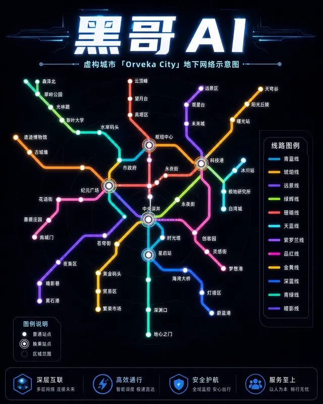
霓虹深色地铁线路图
虚构城市「Orveka City」地下网络的简洁线路示意图,背景为近黑色(#0d0d14)。十二条彩色线路以45度角弧线交织,包括荧光绿、霓虹珊瑚红、天蓝、琥珀、紫罗兰等。站点为白色圆点,换乘站为多环标记。站名以紧凑无衬线字体显示,带轻微辉光效果。图例列出「Cerulean Line」「Amber Line」「Van…
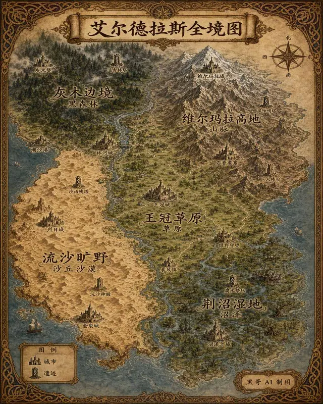
插画风奇幻世界全览地图
生成一张 4:5 竖版「插画风奇幻世界全览地图」案例图,所属分类为「地图与制图」。奇幻大陆地图,羊皮纸背景,各区域彩绘、城堡图标与花体地名。画面需要完整呈现上述主体、构图、配色、材质、光线和整体风格;可见文字以自然简体中文为主,必要的技术缩写、代码、变量名、学术符号、单位、拉丁物种名或装饰性外文可保留。
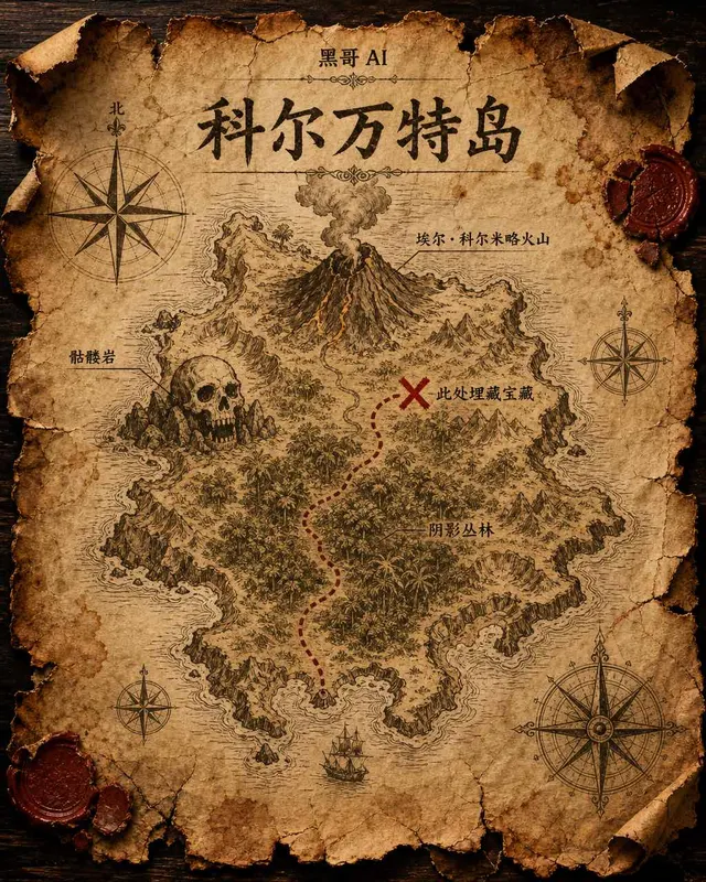
藏宝岛羊皮纸地图
虚构岛屿「Isla de Corvante」的磨损羊皮纸藏宝图,以泛黄墨水绘于皱折牛皮纸上。海岸线用细致排线描绘,内陆有火山「El Colmillo」、丛林「Selva Sombría」、骷髅岩「Peñasco Calavera」,以及标注「Aquí yace el tesoro」的X宝藏位置。虚线小径从南岸海湾穿越…