地质剖面插画图
中文完整提示词
「Valdecrest Formation」虚构地质剖面详图,以20世纪中叶科学插画风格呈现。水平切面穿越山脉,揭示地壳层状地层,每层以不同纹理区分:花岗岩底基为斜线排线,石灰岩为水平虚线,页岩为交叉排线,砂岩为点刻。左侧沉积序列陡倾入向斜,侵入岩脉以实心深洋红色垂直贯穿。断层线以粗锯齿线配位移箭头标示,层名「Mirehan Limestone」「Greyfen Shale」「Torval Granite」以斜体块字标注,左侧垂直比例尺标注深度,色调为赭石、橄榄绿、奶油色、锈红与板岩蓝。
English full prompt
A detailed illustrated geological cross-section showing the fictional "Valdecrest Formation", presented in the style of a mid-century scientific illustration. The horizontal slice cuts through a mountain range, revealing layered strata in the Earth's crust. Each layer is labelled and filled with a distinct texture pattern: diagonal hatching for granite basement, horizontal dashes for limestone, cross-hatching for shale, and stipple dots for sandstone. A hanging sedimentary sequence on the left side dips steeply into a syncline. An intrusive igneous dike cuts vertically through the layers, filled with solid dark magenta. Fault lines are shown as bold zigzag lines with displacement arrows. Layer names appear in italic block text: "Mirehan Limestone", "Greyfen Shale", "Torval Granite". A vertical scale bar on the left marks depth in metres. The colour palette uses ochre, olive, cream, rust, and slate — the muted pigment tones of a scientific handbook illustration from the 1950s.
相关案例
-
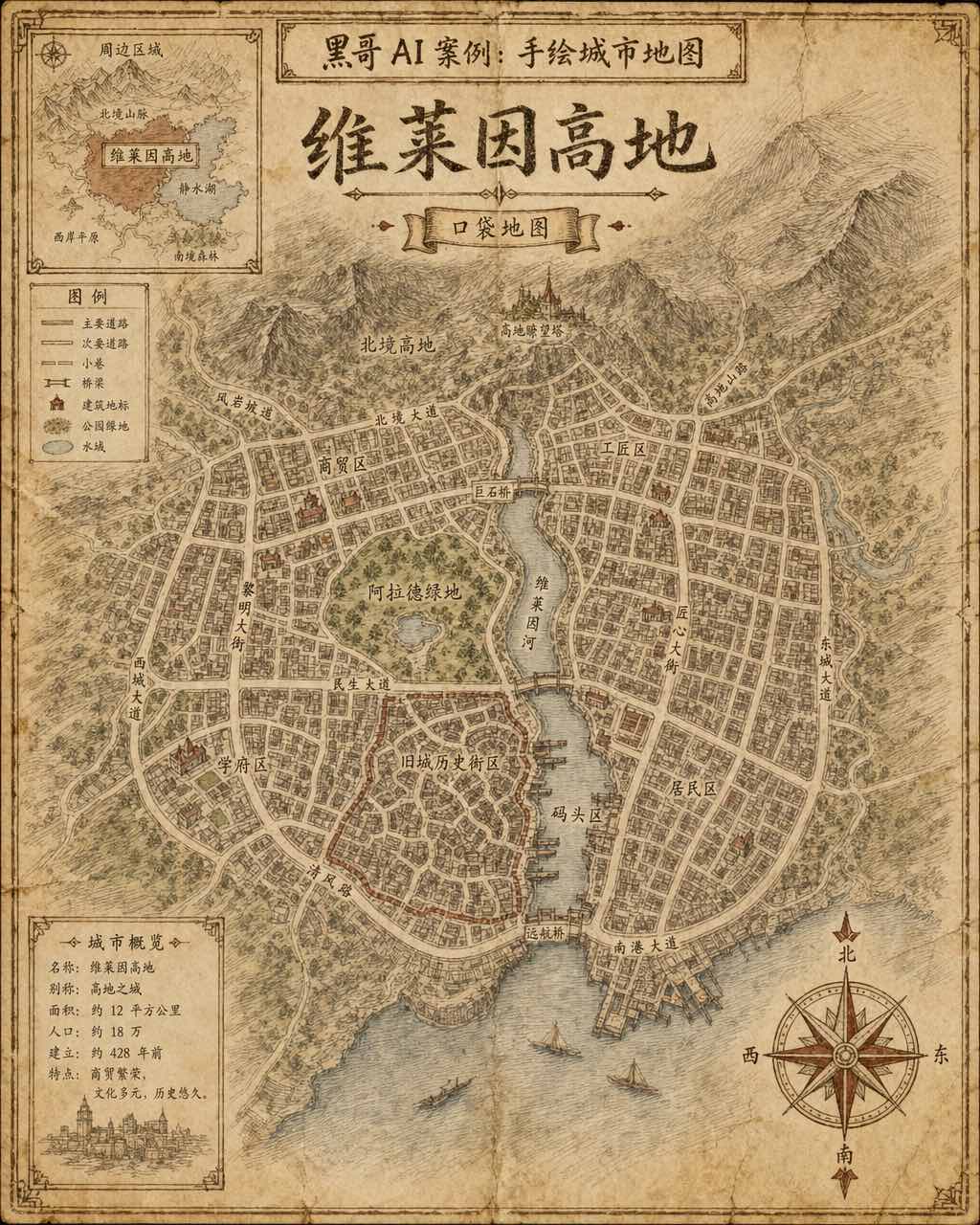
手绘虚构城市地图
一张虚构城市「Verlaine Heights」的手绘街道地图,以棕色墨水绘于泛黄奶油色绘图纸上,俯视正交视角。密集的街道网格、一条将城市一分为二的河流、中央公园标注为「Allard Green」,以及蜿蜒的历史街区。街道名以略显不规则的衬线手写体标注,右下角绘有装饰性罗盘玫瑰,左上角有显示周边区域的小插图。铅笔排线…
-

霓虹深色地铁线路图
虚构城市「Orveka City」地下网络的简洁线路示意图,背景为近黑色(#0d0d14)。十二条彩色线路以45度角弧线交织,包括荧光绿、霓虹珊瑚红、天蓝、琥珀、紫罗兰等。站点为白色圆点,换乘站为多环标记。站名以紧凑无衬线字体显示,带轻微辉光效果。图例列出「Cerulean Line」「Amber Line」「Van…
-
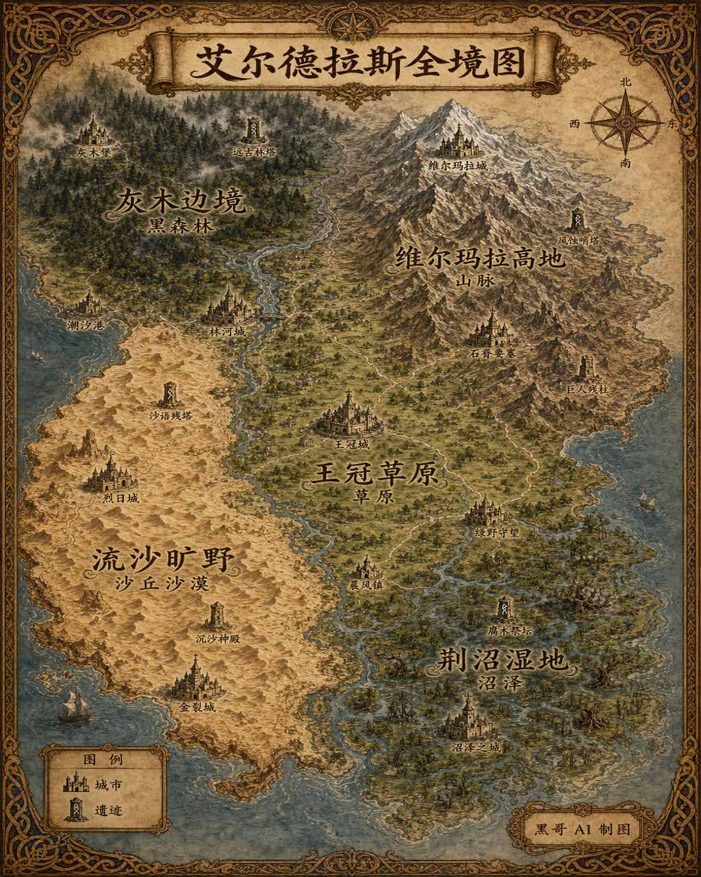
插画风奇幻世界全览地图
生成一张 4:5 竖版「插画风奇幻世界全览地图」案例图,所属分类为「地图与制图」。奇幻大陆地图,羊皮纸背景,各区域彩绘、城堡图标与花体地名。画面需要完整呈现上述主体、构图、配色、材质、光线和整体风格;可见文字以自然简体中文为主,必要的技术缩写、代码、变量名、学术符号、单位、拉丁物种名或装饰性外文可保留。
-
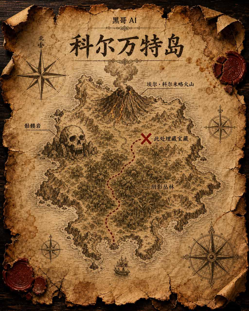
藏宝岛羊皮纸地图
虚构岛屿「Isla de Corvante」的磨损羊皮纸藏宝图,以泛黄墨水绘于皱折牛皮纸上。海岸线用细致排线描绘,内陆有火山「El Colmillo」、丛林「Selva Sombría」、骷髅岩「Peñasco Calavera」,以及标注「Aquí yace el tesoro」的X宝藏位置。虚线小径从南岸海湾穿越…